
IMAGES TAKEN NEAR TO
Charlcutt, CALNE, SN11 9HH
Introduction
This page details the photographs taken nearby to SN11 9HH by members of the Geograph project.
The Geograph project started in 2005 with the aim of publishing, organising and preserving representative images for every square kilometre of Great Britain, Ireland and the Isle of Man.

There are currently over 7.5m images from over14,400 individuals and you can help contribute to the project by visiting https://www.geograph.org.uk
Image Map
Images are licensed for reuse under creativecommons.org/licenses/by-sa/2.0
Notes
- Clicking on the map will re-center to the selected point.
- The higher the marker number, the further away the image location is from the centre of the postcode.
Image Listing (7 Images Found)
Images are licensed for reuse under creativecommons.org/licenses/by-sa/2.0
Image
Details
Distance
1
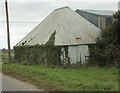
2009 : Ancient and modern
I may be old and rusty but I can still hold my share of winter feed. That barn is getting on a bit as well.
A pair of barns and a post for power lines.
Image: © Maurice Pullin
Taken: 25 Sep 2009
0.01 miles
2
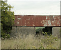
2009 : Rusty old barn on the road to Charlcutt
Oh! I don't know, new roof, tidy the garden a bit, clean it out, have to do something about those walls, we could make something of it.
Image: © Maurice Pullin
Taken: 25 Sep 2009
0.04 miles
3
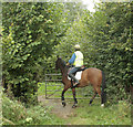
2009 : Opening a gate with a horse
Well, no, that wasn't quite what I meant.
The gate was closed and latched and the rider gave a demonstration of how to open and close it without dismounting.
Was rather intrigued by a notice on the gate which I shall show you when the horse moves over a bit.
Image: © Maurice Pullin
Taken: 25 Sep 2009
0.08 miles
4
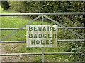
2009 : Strange sign on the way to Charlcutt
Now the horse has moved over we can see the sign.
I think this means holes made by badgers rather than ... well, never mind.
A lady who was passing told me it is a warning to horse riders who come this way.
Image: © Maurice Pullin
Taken: 25 Sep 2009
0.08 miles
5
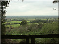
2009 : Scene through a gap in the hedgerow
Looking west on the lane to Charlcutt.
Over a patchwork of fields north of Chippenham.
Image: © Maurice Pullin
Taken: 25 Sep 2009
0.09 miles
6
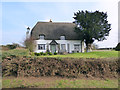
Pipers Cottage
Grade II Listed thatched cottage. http://www.britishlistedbuildings.co.uk/en-316154-pipers-cottage-bremhill-#.VucEZ__cuUk
Image: © Vieve Forward
Taken: 12 Mar 2016
0.20 miles
7
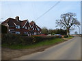
Council Houses
Marked as "Council Houses" on the OS map, but might now be owner-occupied.
Image: © Vieve Forward
Taken: 12 Mar 2016
0.24 miles