IMAGES TAKEN NEAR TO
Olivers Hill, CALNE, SN11 8UR
Introduction
This page details the photographs taken nearby to Olivers Hill, SN11 8UR by members of the Geograph project.
The Geograph project started in 2005 with the aim of publishing, organising and preserving representative images for every square kilometre of Great Britain, Ireland and the Isle of Man.

There are currently over 7.5m images from over14,400 individuals and you can help contribute to the project by visiting https://www.geograph.org.uk
Image Map
Images are licensed for reuse under creativecommons.org/licenses/by-sa/2.0
Notes
- Clicking on the map will re-center to the selected point.
- The higher the marker number, the further away the image location is from the centre of the postcode.
Image Listing (12 Images Found)
Images are licensed for reuse under creativecommons.org/licenses/by-sa/2.0
Image
Details
Distance
1
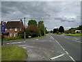
Junction on the A4 to get into Cherhill, looking east
Image: © Rob Purvis
Taken: 13 Aug 2017
0.03 miles
2
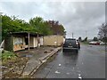
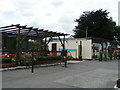
The Divine Cafe has moved
This location on Labour-in-Vain Hill was formerly the Silent Circle Cafe Image, more recently the Divine Cafe, which has now moved a little west to Calne https://divineonthegreen.co.uk , leaving these rather forlorn structures behind. The area has now become a de facto car park, though I am not sure whose cars these are; possibly they go with the houses opposite though one would have to cross the busy A4 to reach them.
[January 2023: the cafe has now reopened as the Dandy Highwayman Coffee Shop https://dandyhighwayman.co.uk/ ]
Image: © HelenK
Taken: 3 May 2021
0.04 miles
3
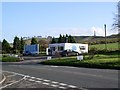
The Silent Circle Cafe, Cherhill
This cafe is situated beside the A4 at the top of Labour-in-Vain Hill.
Image: © Chris Henley
Taken: 23 Nov 2006
0.05 miles
4
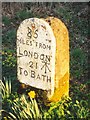
Old Milestone by the A4, Labour in Vain Hill, Cherhill
Calne stone plaque by the A4, in parish of Cherhill (North Wiltshire District), Labour in Vain Hill, opposite Nos. 1 and 2, lower side of Cherhill, on wide grass verge near '40' mph signs.
Inscription reads:-
85
MILES FROM
LONDON
21
TO BATH
Cancelled carved benchmark to the right of '21'.
Grade II listed.
List Entry Number: 1199467 https://historicengland.org.uk/listing/the-list/list-entry/1199467
Surveyed
Milestone Society National ID: WI_lb85
Image: © Milestone Society
Taken: Unknown
0.06 miles
5
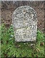
Old Milestone by the A4, Labour in Vain Hill, Cherhill
Calne stone plaque by the A4, in parish of Cherhill (North Wiltshire District), Labour in Vain Hill, opposite Nos. 1 and 2, lower side of Cherhill, on wide grass verge near '40' mph signs. An earlier photograph can be found here https://www.geograph.org.uk/photo/6114450.
Inscription reads:-
85
MILES FROM
LONDON
21
TO BATH
Cancelled carved benchmark to the right of '21'.
Grade II listed.
List Entry Number: 1199467 https://historicengland.org.uk/listing/the-list/list-entry/1199467
Milestone Society National ID: WI_LB85
Image: © Abigail Newton
Taken: 18 Dec 2020
0.06 miles
8
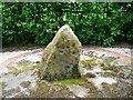
Cherhill bus shelter sundial, Cherhill
The bus shelter is a millennium project. The sundial consists of a vertical sarsen stone inside a 'face' of Roman numerals. The intention is to symbolize the passage of time. The local bus company probably use more modern time-keeping methods.
Image: © Brian Robert Marshall
Taken: 21 May 2008
0.19 miles
9
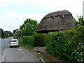
Cherhill bus shelter, Cherhill
The shelter is a millennium project. The timber frame was supplied and erected by a local green oak company and thatched by David Grafton, a local craftsman. Within the shelter is a sundial http://www.geograph.org.uk/photo/811093
Image: © Brian Robert Marshall
Taken: 21 May 2008
0.19 miles