
IMAGES TAKEN NEAR TO
Quemerford, CALNE, SN11 8UA
Introduction
This page details the photographs taken nearby to Quemerford, SN11 8UA by members of the Geograph project.
The Geograph project started in 2005 with the aim of publishing, organising and preserving representative images for every square kilometre of Great Britain, Ireland and the Isle of Man.

There are currently over 7.5m images from over14,400 individuals and you can help contribute to the project by visiting https://www.geograph.org.uk
Image Map
Images are licensed for reuse under creativecommons.org/licenses/by-sa/2.0
Notes
- Clicking on the map will re-center to the selected point.
- The higher the marker number, the further away the image location is from the centre of the postcode.
Image Listing (18 Images Found)
Images are licensed for reuse under creativecommons.org/licenses/by-sa/2.0
Image
Details
Distance
1
![Alongside the brook [1]](https://s2.geograph.org.uk/geophotos/05/41/79/5417938_a67b5528_120x120.jpg)
Alongside the brook [1]
The footpath runs in a fenced area alongside the oddly named River's Brook.
Image: © Michael Dibb
Taken: 24 May 2017
0.09 miles
2
![Alongside the brook [2]](https://s1.geograph.org.uk/geophotos/05/41/79/5417941_b3ffc986_120x120.jpg)
Alongside the brook [2]
The footpath continues to run alongside the oddly named River's Brook, here through a more wooded area.
Image: © Michael Dibb
Taken: 24 May 2017
0.09 miles
3
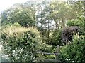
Into the field
The footpath crosses the stile between a wooded area and an open field.
Image: © Michael Dibb
Taken: 24 May 2017
0.10 miles
4
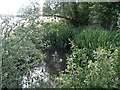
Gently flows the brook
The footpath crosses the oddly named River's Brook.
Image: © Michael Dibb
Taken: 24 May 2017
0.12 miles
5
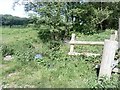
Superfluous stile
The stile near where the footpath crosses the brook is not needed as the gateway alongside no longer has a gate.
Image: © Michael Dibb
Taken: 24 May 2017
0.12 miles
6
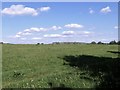
Open field view
After crossing the stile, the footpath comes into this open field. The Cherhill Monument and white horse can be seen in the distance.
Image: © Michael Dibb
Taken: 24 May 2017
0.13 miles
7
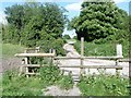
Footpath and track
The track straight ahead leads to Lower Sands Farm. To the right the track leads to Quemerford Farm.
Image: © Michael Dibb
Taken: 24 May 2017
0.15 miles
8
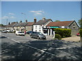
Quemerford Post Office and Stores
On the north side of the A4 south-east of Calne.
Image: © Jonathan Billinger
Taken: 6 May 2008
0.16 miles
9
![Grassy path [1]](https://s1.geograph.org.uk/geophotos/05/41/79/5417961_7a0a4328_120x120.jpg)
Grassy path [1]
The footpath continues in a grassy area.
Image: © Michael Dibb
Taken: 24 May 2017
0.17 miles
10
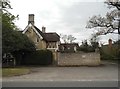
Houses on Quemerford
The road and village name alike
Image: © David Howard
Taken: 24 Apr 2016
0.19 miles