
IMAGES TAKEN NEAR TO
Hoppingstones, CALNE, SN11 8SS
Introduction
This page details the photographs taken nearby to Hoppingstones, SN11 8SS by members of the Geograph project.
The Geograph project started in 2005 with the aim of publishing, organising and preserving representative images for every square kilometre of Great Britain, Ireland and the Isle of Man.

There are currently over 7.5m images from over14,400 individuals and you can help contribute to the project by visiting https://www.geograph.org.uk
Image Map
Images are licensed for reuse under creativecommons.org/licenses/by-sa/2.0
Notes
- Clicking on the map will re-center to the selected point.
- The higher the marker number, the further away the image location is from the centre of the postcode.
Image Listing (6 Images Found)
Images are licensed for reuse under creativecommons.org/licenses/by-sa/2.0
Image
Details
Distance
1
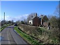
Hoppingstone cottages
Isolated cottages on Highway Common.
Image: © Roger Cornfoot
Taken: 21 Jan 2007
0.01 miles
2
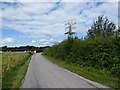
Windpump near Hoppingstone Cottages
Scaffolding around the remains of a windpump. The road has just been resurfaced.
Image: © Vieve Forward
Taken: 31 Jul 2016
0.02 miles
3
Hoppingstone Cottages, Wiltshire
Looking southeast over farmland from the vicinity of Hoppingstone Cottages. Highway Hill can be seen in the distance on the horizon.
Image: © Rebecca A Wills
Taken: 19 Sep 2021
0.06 miles
4
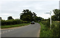
2011 : Two signposts on the road to Bushton
The first is to Goatacre, the second to Highway.
Image: © Maurice Pullin
Taken: 28 Jun 2011
0.24 miles
5
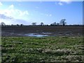
Farmland near Bushton Road
Looking across a huge field towards Lower Littlecot farm.
Image: © Roger Cornfoot
Taken: 21 Jan 2007
0.25 miles
6
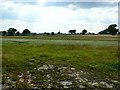
A field near Hilmarton
Not a very exciting field it has to be said. The tree at the far right of the image stands alone in the field 100 metres from the hedge on the horizon.
Image: © Brian Robert Marshall
Taken: 27 Jul 2008
0.25 miles