
IMAGES TAKEN NEAR TO
Rodwell, CALNE, SN11 8SL
Introduction
This page details the photographs taken nearby to Rodwell, SN11 8SL by members of the Geograph project.
The Geograph project started in 2005 with the aim of publishing, organising and preserving representative images for every square kilometre of Great Britain, Ireland and the Isle of Man.

There are currently over 7.5m images from over14,400 individuals and you can help contribute to the project by visiting https://www.geograph.org.uk
Image Map
Images are licensed for reuse under creativecommons.org/licenses/by-sa/2.0
Notes
- Clicking on the map will re-center to the selected point.
- The higher the marker number, the further away the image location is from the centre of the postcode.
Image Listing (6 Images Found)
Images are licensed for reuse under creativecommons.org/licenses/by-sa/2.0
Image
Details
Distance
2

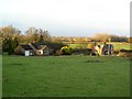
2011 : Farmland east of Hilmarton
Fields and autumn tinted hedgerows on the way to Rodwell Farm.
A crow wheels overhead looking for a snack.
One crow is often seen.
Two crows are sometimes seen.
Three crows are rooks.
Image: © Maurice Pullin
Taken: 6 Nov 2011
0.12 miles
3
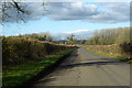
Road from Compton Bassett to Hilmarton
Image: © Robin Webster
Taken: 2 Feb 2018
0.13 miles
4
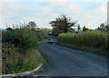
2011 : Minor road to Bushton and Wootton Bassett
Heading north east, a useful road circumventing Hilmarton and Lyneham.
Image: © Maurice Pullin
Taken: 6 Nov 2011
0.19 miles
5

Farm entrance, near Hilmarton
This is probably the back passage into the farm. It has another access from the road to Compton Bassett.
Image: © Brian Robert Marshall
Taken: 10 Dec 2008
0.19 miles
6

2011 : Minor road to Bushton and Wootton Bassett
The Lyneham bypass, for those in the know.
Clevancy and Clyffe Pypard are at the foot of the escarpment to the right.
Image: © Maurice Pullin
Taken: 6 Nov 2011
0.20 miles