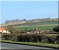
IMAGES TAKEN NEAR TO
Green Lane, CALNE, SN11 8QQ

Introduction

This page details the photographs taken nearby to Green Lane, SN11 8QQ by members of the Geograph project.

The Geograph project started in 2005 with the aim of publishing, organising and preserving representative images for every square kilometre of Great Britain, Ireland and the Isle of Man.

There are currently over 7.5m images from over14,400 individuals and you can help contribute to the project by visiting https://www.geograph.org.uk

Image Map


Images are licensed for reuse under creativecommons.org/licenses/by-sa/2.0
Notes
  • Clicking on the map will re-center to the selected point.
  • The higher the marker number, the further away the image location is from the centre of the postcode.

Image Listing (7 Images Found)

Images are licensed for reuse under creativecommons.org/licenses/by-sa/2.0
Image
Details
Distance
1
2012 : East from the A4 near Hayle's Corner
The Cherhill White Horse and the Lansdowne Monument are beyond the cottages.
Image: © Maurice Pullin Taken: 11 Mar 2012
0.19 miles
2
Parking area on the A4, Quemerford Gate
Image: © David Howard Taken: 24 Apr 2016
0.20 miles
3
Kebab van in A4 layby
The van seen at the far end of the layby is variously known as Ozzie Kebabs, Ozzy's Kebabs or Ozzy Kebab. Like the one in Image, this van is a nearly permanent feature of the A4 and has a steady stream of customers. The layby is just west of Cherhill, on the approach to Calne, and is not much used except by lovers of kebabs.
Image: © HelenK Taken: 2 May 2022
0.21 miles
4
The A4, Quemerford Gate
Image: © David Howard Taken: 24 Apr 2016
0.21 miles
5
Parking area on the A4, Quemerford Gate
Image: © David Howard Taken: 24 Apr 2016
0.21 miles
6
Parking area on the A4, Quemerford Gate
Image: © David Howard Taken: 24 Apr 2016
0.22 miles
7
Labour in vain hill, A4
Image: © Alex McGregor Taken: 21 Jul 2015
0.24 miles