
IMAGES TAKEN NEAR TO
Quemerford, CALNE, SN11 8LE
Introduction
This page details the photographs taken nearby to Quemerford, SN11 8LE by members of the Geograph project.
The Geograph project started in 2005 with the aim of publishing, organising and preserving representative images for every square kilometre of Great Britain, Ireland and the Isle of Man.

There are currently over 7.5m images from over14,400 individuals and you can help contribute to the project by visiting https://www.geograph.org.uk
Image Map
Images are licensed for reuse under creativecommons.org/licenses/by-sa/2.0
Notes
- Clicking on the map will re-center to the selected point.
- The higher the marker number, the further away the image location is from the centre of the postcode.
Image Listing (30 Images Found)
Images are licensed for reuse under creativecommons.org/licenses/by-sa/2.0
Image
Details
Distance
1
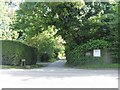
Start of Bridleway
From the A4 road, the bridleway leads to Blackland Park and St Peter's church.
Image: © Michael Dibb
Taken: 24 May 2017
0.03 miles
2
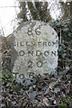
Milestone on A4 London Road Quemerford
Calne stone plaque by the A4, in parish of Calne Without (North Wiltshire District), Quemerford, opposite Nos 327 & 329 London Road, in nettles under bushes immediately West of lay-by. Inscription reads:- 86 MILES FROM LONDON 20 TO BATH Carved benchmark recorded on lower face. Grade II listed. List Entry Number: 1254365 Surveyed Milestone Society National ID: WI_LB86
Image: © Doug Roseaman
Taken: 13 Feb 2023
0.04 miles
3
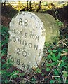
Old Milestone by the A4, London Road, Quemerford
Calne stone plaque by the A4, in parish of Calne Without (North Wiltshire District), Quemerford, opposite No. 329 London Road, in nettles under bushes on West end of lay-by.
Inscription reads:-
86
MILES FROM
LONDON
20
TO BATH
Carved benchmark recorded on lower face.
Grade II listed.
List Entry Number: 1254365 https://historicengland.org.uk/listing/the-list/list-entry/1254365
Surveyed
Milestone Society National ID: WI_lb86
Image: © Milestone Society
Taken: Unknown
0.04 miles
4
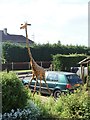
Watching the traffic on the A4 with a long neck
Seen in a garden alongside the A4.
Image: © Michael Dibb
Taken: 24 May 2017
0.09 miles
5
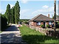
Footpath leaves the road
The footpath (CLAN21) runs from the A4 to join another footpath (CALW35) near Quemerford Common farm.
Image: © Michael Dibb
Taken: 24 May 2017
0.11 miles
6
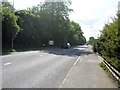
Welcome to Caln
The busy A4 road approaching Calne.
Image: © Michael Dibb
Taken: 24 May 2017
0.12 miles
8
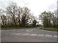
The road to Devizes, Quemerford
No name as yet
Image: © David Howard
Taken: 24 Apr 2016
0.15 miles
9
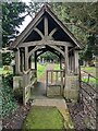
Lychgate, St Peter's Church, Blackland
Lychgate of St Peter's Church, Blackland, near Calne
Image: © Steve Roberts
Taken: 15 Mar 2022
0.16 miles
10
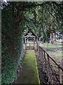
Path and lychgate, St Peter's Church, Blackland
The path is the only public access to St Peter's church, Blackland, near Calne.
Image: © Steve Roberts
Taken: 15 Mar 2022
0.16 miles