IMAGES TAKEN NEAR TO
Yatesbury, CALNE, SN11 8HS
Introduction
This page details the photographs taken nearby to SN11 8HS by members of the Geograph project.
The Geograph project started in 2005 with the aim of publishing, organising and preserving representative images for every square kilometre of Great Britain, Ireland and the Isle of Man.

There are currently over 7.5m images from over14,400 individuals and you can help contribute to the project by visiting https://www.geograph.org.uk
Image Map
Images are licensed for reuse under creativecommons.org/licenses/by-sa/2.0
Notes
- Clicking on the map will re-center to the selected point.
- The higher the marker number, the further away the image location is from the centre of the postcode.
Image Listing (10 Images Found)
Images are licensed for reuse under creativecommons.org/licenses/by-sa/2.0
Image
Details
Distance
1
WW2 huts on farmland
Now utilised for agricultural storage, these are some of the many buildings surviving from the days of RAF Yatesbury.
Image: © Roger Cornfoot
Taken: 15 Feb 2007
0.01 miles
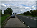
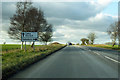
2
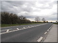
Junction of Yatesbury road and A4
Here, the A4 passes the junction with the minor road to the village of Yatesbury.
Image: © Vieve Forward
Taken: 6 Dec 2014
0.19 miles
3
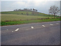
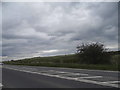
The A4 at Cherhill Down
From the top of the hill near the Yatesbury road looking south-west to White Horse Plantation on Cherhill Hill.
Image: © Trevor Rickard
Taken: 22 Apr 2009
0.20 miles
7
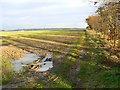
Trees, mud and a young crop, near Yatesbury
The small plantation on the right is on the 1:25K map but not named. It is too early to identify the crop. The clumps of trees on the far horizon on the left mark the line of the Ridgeway at Hackpen.
Image: © Brian Robert Marshall
Taken: 19 Nov 2008
0.22 miles
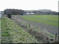
8
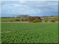
Farmland, Cherhill
In the foreground is a crop of oil-seed rape. Beyond the A4 is a modern barn with the buildings of the former RAF Yatesbury in the distance.
Image: © Andrew Smith
Taken: 26 Feb 2011
0.22 miles
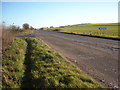
10
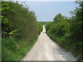
Byway to the A4
This short byway connects the Old Bath Road, now a track to the present A4 which is the modern route to Bath.
Image: © Chris Heaton
Taken: 28 Apr 2007
0.25 miles