
IMAGES TAKEN NEAR TO
Carnegie Mews, New Road, CALNE, SN11 0SQ
Introduction
This page details the photographs taken nearby to Carnegie Mews, New Road, SN11 0SQ by members of the Geograph project.
The Geograph project started in 2005 with the aim of publishing, organising and preserving representative images for every square kilometre of Great Britain, Ireland and the Isle of Man.

There are currently over 7.5m images from over14,400 individuals and you can help contribute to the project by visiting https://www.geograph.org.uk
Image Map
Images are licensed for reuse under creativecommons.org/licenses/by-sa/2.0
Notes
- Clicking on the map will re-center to the selected point.
- The higher the marker number, the further away the image location is from the centre of the postcode.
Image Listing (214 Images Found)
Images are licensed for reuse under creativecommons.org/licenses/by-sa/2.0
Image
Details
Distance
2
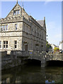
Stopping at the Town Hall
The Wilts and Berks Canal branched off from Stanley and reached all the way to here. The canal itself terminated at the old mill and a large wharf catered for the goods from 1802. The mill was demolished and the Town Hall now stands here, being built in 1886.
Image: © Neil Owen
Taken: 22 Sep 2014
0.02 miles

4

2010 : Former canal wharf, Calne
At the end of the Calne branch of the now closed Wilts and Berks Canal.
The A4 London Road passes on the opposite bank with 33 bus to Chippenham.
Image: © Maurice Pullin
Taken: 16 Apr 2010
0.03 miles
5

17th Century Almshouses, Calne.
These Almshouses built about 1682 by the son of Robert Tomson, Bishop of Salisbury. For detail of the wall plaque, see Image
Image: © Derek Voller
Taken: 23 Jul 2009
0.03 miles
6

Bank House
The Tourist Information Centre on The Strand occupies a former bank. See Image] for a give-away detail.
Image: © Neil Owen
Taken: 22 Sep 2014
0.03 miles
7

At the sign of the locust
The town's tourism centre is housed in a former bank - the night safe has been retained in the wall.
Image: © Neil Owen
Taken: 22 Sep 2014
0.03 miles
8
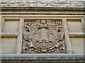
Faith, Work, Service
Calne's crest as it appears on the Town Hall. The feathers are that appertaining to the Duke of Cornwall, indicating the town's former inclusion of the Duchy. The crest was recorded after the Visitation of 1565.
Image: © Neil Owen
Taken: 22 Sep 2014
0.03 miles
9

New Rd Calne.
View north along the river which runs along New Rd which is an extension of High St and which becomes the London Rd the A4 as it runs south through the town.
Image: © Nigel Mykura
Taken: 15 Jun 2010
0.03 miles
10
![A walk around Calne [1]](https://s3.geograph.org.uk/geophotos/06/76/17/6761783_cf6903c8_120x120.jpg)
A walk around Calne [1]
Alongside the Old Bath Road (A4) stands Calne Town Hall. Built circa 1886 in squared, coursed, limestone rubble in the Tudor Revival style. Listed, grade II, with details at: https://historicengland.org.uk/listing/the-list/list-entry/1270827
From the town centre the route leads through mostly modern housing before meeting open countryside after crossing the recently built A3102. After passing Calne Sewage Works and crossing both the abandoned Wilts and Berks canal and the River Marden the route joins the dismantled Calne Branch railway which is followed back to the town centre where it crosses the canal again. About 3½ miles.
Image: © Michael Dibb
Taken: 7 Oct 2020
0.03 miles