
IMAGES TAKEN NEAR TO
Heddington, CALNE, SN11 0NY
Introduction
This page details the photographs taken nearby to SN11 0NY by members of the Geograph project.
The Geograph project started in 2005 with the aim of publishing, organising and preserving representative images for every square kilometre of Great Britain, Ireland and the Isle of Man.

There are currently over 7.5m images from over14,400 individuals and you can help contribute to the project by visiting https://www.geograph.org.uk
Image Map
Images are licensed for reuse under creativecommons.org/licenses/by-sa/2.0
Notes
- Clicking on the map will re-center to the selected point.
- The higher the marker number, the further away the image location is from the centre of the postcode.
Image Listing (14 Images Found)
Images are licensed for reuse under creativecommons.org/licenses/by-sa/2.0
Image
Details
Distance
2
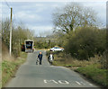
2009 : Knight and squire near Heddington Wick
Shouldn't there be a lance somewhere? You can't defend the good without a lance.
Image: © Maurice Pullin
Taken: 22 Feb 2009
0.08 miles
4
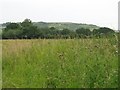
Field near Heddington Wick
Looking towards Beacon Hill Image
Image: © Doug Lee
Taken: 25 Jun 2006
0.12 miles
5
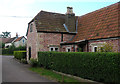
Old Toll House near Heddington Wick
Toll House by the UC road, in parish of Heddington (North Wiltshire District), Turnpike Farm, Heddington Wick, SN11 0PA.
Surveyed
Milestone Society National ID: WI.HED
Image: © Alan Rosevear
Taken: Unknown
0.16 miles
6
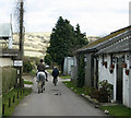
2009 : A horse ridden past Turnpike Farm
Beacon Hill is in the background.
Image: © Maurice Pullin
Taken: 22 Feb 2009
0.16 miles
7
![A walk around Bromham [28]](https://s3.geograph.org.uk/geophotos/07/44/15/7441563_85e4ac2d_120x120.jpg)
A walk around Bromham [28]
Turnpike Cottage on The Turnpike. What is now a minor road to the left and a byway to the right was once the main road from London to Bath. In the 17th century this road diverged from the London to Bristol road at Beckhampton, crossed the flat downland and ran over the summit of Beacon Hill before descending towards Sandy Lane. It declined in importance from the mid 18th century when London to Bath traffic began to use the Bristol road through Calne, and it was disturnpiked in 1790.
From the car park in front of the Greyhound public house, the route leads through fields and along Highfield to cross the A342 road. The next path leads past Bromham House Farm to Turnpike Farm and on to Wick Farm. Then paths through fields to Chittoe Heath and along minor roads to Nonsuch Nurseries. Another path through fields leads to a surfaced path at the edge of Wyatt’s Wood, this leads to the High Street and back to the starting point. Almost exactly 4 miles.
Image: © Michael Dibb
Taken: 26 Feb 2023
0.17 miles
8
![A walk around Bromham [26]](https://s3.geograph.org.uk/geophotos/07/44/15/7441559_e215f912_120x120.jpg)
A walk around Bromham [26]
The path continues along the field edge towards the buildings of Turnpike Farm.
From the car park in front of the Greyhound public house, the route leads through fields and along Highfield to cross the A342 road. The next path leads past Bromham House Farm to Turnpike Farm and on to Wick Farm. Then paths through fields to Chittoe Heath and along minor roads to Nonsuch Nurseries. Another path through fields leads to a surfaced path at the edge of Wyatt’s Wood, this leads to the High Street and back to the starting point. Almost exactly 4 miles.
Image: © Michael Dibb
Taken: 26 Feb 2023
0.17 miles
9
![A walk around Bromham [25]](https://s2.geograph.org.uk/geophotos/07/44/15/7441558_7bd8bb6b_120x120.jpg)
A walk around Bromham [25]
A view across the flat fields towards the village of Heddington. On the skyline can be seen the twin communication towers on Morgan's Hill, just over 3 miles distant.
From the car park in front of the Greyhound public house, the route leads through fields and along Highfield to cross the A342 road. The next path leads past Bromham House Farm to Turnpike Farm and on to Wick Farm. Then paths through fields to Chittoe Heath and along minor roads to Nonsuch Nurseries. Another path through fields leads to a surfaced path at the edge of Wyatt’s Wood, this leads to the High Street and back to the starting point. Almost exactly 4 miles.
Image: © Michael Dibb
Taken: 26 Feb 2023
0.17 miles
10
![A walk around Bromham [27]](https://s0.geograph.org.uk/geophotos/07/44/15/7441560_a05623c7_120x120.jpg)
A walk around Bromham [27]
A view back along the path from the road at Turnpike Farm.
From the car park in front of the Greyhound public house, the route leads through fields and along Highfield to cross the A342 road. The next path leads past Bromham House Farm to Turnpike Farm and on to Wick Farm. Then paths through fields to Chittoe Heath and along minor roads to Nonsuch Nurseries. Another path through fields leads to a surfaced path at the edge of Wyatt’s Wood, this leads to the High Street and back to the starting point. Almost exactly 4 miles.
Image: © Michael Dibb
Taken: 26 Feb 2023
0.18 miles