IMAGES TAKEN NEAR TO
Lavington Road, DEVIZES, SN10 5RF

Introduction

This page details the photographs taken nearby to Lavington Road, SN10 5RF by members of the Geograph project.

The Geograph project started in 2005 with the aim of publishing, organising and preserving representative images for every square kilometre of Great Britain, Ireland and the Isle of Man.

There are currently over 7.5m images from over14,400 individuals and you can help contribute to the project by visiting https://www.geograph.org.uk

Image Map


Images are licensed for reuse under creativecommons.org/licenses/by-sa/2.0
Notes
  • Clicking on the map will re-center to the selected point.
  • The higher the marker number, the further away the image location is from the centre of the postcode.

Image Listing (12 Images Found)

Images are licensed for reuse under creativecommons.org/licenses/by-sa/2.0
Image
Details
Distance
1
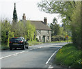
A360 northbound
Image: © Alex McGregor Taken: 17 Jul 2015
0.03 miles
2
2009 : Freith Farm across the fields
It is just possible to see the top of the Salisbury Plain western escarpment to the left. This would be somewhere near Urchfont.
Image: © Maurice Pullin Taken: 20 Apr 2009
0.09 miles
3
Orchard barrier trees A360 near Black Dog Farm
Between Potterne and the Lavington/Worton junction on the A360 lies a now grubbed-up orchard. The only remaining feature is the very tall barrier trees around the perimeter of the field.
Image: © Philip Reed Taken: 21 Aug 2008
0.09 miles
4
2009 : Freith Farm field
Waiting for the cattle? Looks good enough for hay (or silage). Easily mown field near the farm, suitable for silage (or hay).
Image: © Maurice Pullin Taken: 20 Apr 2009
0.12 miles
5
Tree planting
Some trees have been planted at the side of the oilseed rape crop.
Image: © Michael Dibb Taken: 20 Apr 2023
0.15 miles
6
Old Milestone north west of Black Dog Farm, Market Lavington Parish
Lavington stone by the UC road, in parish of Market Lavington (Kennet District), North West of Black Dog Farm; 5m North of the junction slip road to the A360(N), on the verge. Broken and may be lost Milestone Society National ID: WI_SELV05.
Image: © Milestone Society Taken: Unknown
0.17 miles
7
Approaching Black Dog Farm on the A360
Image: © Anthony Parkes Taken: 2 Aug 2021
0.20 miles
8
Dewey's Water crossroads [6]
Alongside the A360 road, just north of the crossroads (the sign for which is seen in the background) stands Black Dog Farm. Dewey’s Water crossroads is a notorious accident blackspot. The minor road from Market Lavington to Worton crosses the main A360 road from Devizes to Salisbury. The junction is on a double bend of the A360, and drivers on both sides of the minor road have limited visibility. Consideration is being given to the installation of traffic lights.
Image: © Michael Dibb Taken: 20 Apr 2023
0.22 miles
9
2009 : A360 passing a cottage near Black Dog Farm
Looking south, Littleton Panell next then over the Salisbury Plain to Tilshead and Shrewton.
Image: © Maurice Pullin Taken: 20 Apr 2009
0.22 miles
10
Road to Worton
An unclassified road which turned out to be much busier than anticipated.
Image: © Robin Webster Taken: 21 Aug 2016
0.23 miles