IMAGES TAKEN NEAR TO
High Street, DEVIZES, SN10 4EL
Introduction
This page details the photographs taken nearby to High Street, SN10 4EL by members of the Geograph project.
The Geograph project started in 2005 with the aim of publishing, organising and preserving representative images for every square kilometre of Great Britain, Ireland and the Isle of Man.

There are currently over 7.5m images from over14,400 individuals and you can help contribute to the project by visiting https://www.geograph.org.uk
Image Map
Images are licensed for reuse under creativecommons.org/licenses/by-sa/2.0
Notes
- Clicking on the map will re-center to the selected point.
- The higher the marker number, the further away the image location is from the centre of the postcode.
Image Listing (24 Images Found)
Images are licensed for reuse under creativecommons.org/licenses/by-sa/2.0
Image
Details
Distance
1
![A short walk around Littleton Panell [3]](https://s3.geograph.org.uk/geophotos/07/36/99/7369935_7e3ecd6a_120x120.jpg)
A short walk around Littleton Panell [3]
Alongside the A360 road and at the entrance to the former Lavington railway station stands this large former public house. Originally the Station Hotel, it became the Chocolate Poodle after the station closed. It is now flats.
Starting from the former Lavington railway station on the Reading to Taunton line, the walk heads south along the A360 road, which becomes Littleton Panell High Street. Turning northeast, the route is along Russell Mill Lane and the ensuing bridleway to Spin Hill. From the junction of Spin Hill and Ledge Hill, a bridleway leads back to the A360 road, which is then followed northwards to the starting point. Just over 2½ miles.
Image: © Michael Dibb
Taken: 21 Dec 2022
0.04 miles
2
![A short walk around Littleton Panell [1]](https://s0.geograph.org.uk/geophotos/07/36/99/7369932_f06628a2_120x120.jpg)
A short walk around Littleton Panell [1]
A car breakers yard now occupies the site of the former Lavington railway station on the Reading to Taunton line. The station opening in 1900 and closed in 1966. Back in the 1920s and 1930s, the Great Western Railway ran weekend excursion trains to Lavington. The trains were met by a fleet of coaches – charabanc style – which took the travellers on to Stonehenge.
Starting from the former Lavington railway station on the Reading to Taunton line, the walk heads south along the A360 road, which becomes Littleton Panell High Street. Turning northeast, the route is along Russell Mill Lane and the ensuing bridleway to Spin Hill. From the junction of Spin Hill and Ledge Hill, a bridleway leads back to the A360 road, which is then followed northwards to the starting point. Just over 2½ miles.
Image: © Michael Dibb
Taken: 21 Dec 2022
0.05 miles
3
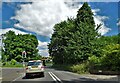
Traffic lights and railway bridge
North of Littleton Panell on the A360
Image: © Neil Theasby
Taken: 13 Jun 2022
0.05 miles
5
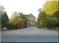
House at entrance to Littleton Panell mobile home park
Image: © David Smith
Taken: 1 Jun 2017
0.05 miles
6
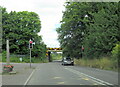
Railway bridge over the A360 north of Littleton Panell
Image: © Roy Hughes
Taken: 14 Jul 2024
0.06 miles
7
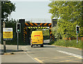
2009 : Railway bridge over the A360
North of Littleton Panell.
Image: © Maurice Pullin
Taken: 11 May 2009
0.06 miles
8
![A short walk around Littleton Panell [2]](https://s2.geograph.org.uk/geophotos/07/36/99/7369934_1af64b02_120x120.jpg)
A short walk around Littleton Panell [2]
The Reading to Taunton railway line crosses the A360 road. The road under the bridge is controlled by traffic lights and there is a height restriction which requires high vehicles to detour through the village of Great Cheverell on very narrow road.
Starting from the former Lavington railway station on the Reading to Taunton line, the walk heads south along the A360 road, which becomes Littleton Panell High Street. Turning northeast, the route is along Russell Mill Lane and the ensuing bridleway to Spin Hill. From the junction of Spin Hill and Ledge Hill, a bridleway leads back to the A360 road, which is then followed northwards to the starting point. Just over 2½ miles.
Image: © Michael Dibb
Taken: 21 Dec 2022
0.07 miles
9
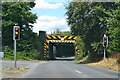
Narrow railway bridge over the A360
Controlled by traffic lights to ensure vehicles don't meet under the bridge.
Image: © David Martin
Taken: 31 Jul 2018
0.07 miles