
IMAGES TAKEN NEAR TO
Horton, DEVIZES, SN10 3NF
Introduction
This page details the photographs taken nearby to SN10 3NF by members of the Geograph project.
The Geograph project started in 2005 with the aim of publishing, organising and preserving representative images for every square kilometre of Great Britain, Ireland and the Isle of Man.

There are currently over 7.5m images from over14,400 individuals and you can help contribute to the project by visiting https://www.geograph.org.uk
Image Map
Images are licensed for reuse under creativecommons.org/licenses/by-sa/2.0
Notes
- Clicking on the map will re-center to the selected point.
- The higher the marker number, the further away the image location is from the centre of the postcode.
Image Listing (62 Images Found)
Images are licensed for reuse under creativecommons.org/licenses/by-sa/2.0
Image
Details
Distance
1
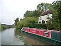
Harepath House, canalside
Looks like [and once was] a small canalside cottage, but has been much extended on the far [north] side.
Image: © Christine Johnstone
Taken: 1 Oct 2013
0.00 miles
2
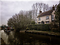
Cottage near Horton Chain Bridge
This cottage is on the Kennet and Avon Canal with mooring frontage, there used to be narrowboats moored here but recently they have moved on.
The canal and cottage are surrounded by farmland, with lovely views to the Northern flanks of the Vale of Pewsey.
Image: © Gillie Rhodes
Taken: 7 Mar 2013
0.00 miles
3
![A circular walk around Horton and Bourton [1]](https://s0.geograph.org.uk/geophotos/06/54/48/6544860_ad740826_120x120.jpg)
A circular walk around Horton and Bourton [1]
Canal Cottage is seen from the towpath, a public footpath and part of the long distance White Horse Trail.
Starting at Horton Chain Bridge, the walk initially runs along the towpath of the Kennet and Avon Canal then follows a path to Horton before crossing the canal and heading to Bourton. A footpath leads to Easton then a bridleway to Harepath Farm and a byway back to the start. About 5 miles including a visit to Horton Mill Farm.
Both Horton and Bourton are former agricultural villages. Horton has no one focus and is principally a linear village whilst Bourton is more compact. To the north of the villages there are many prehistoric and medieval earthworks including Wansdyke. Fishwater, a marshy hollow at Bourton is the source of the western headwater of the Salisbury River Avon.
Image: © Michael Dibb
Taken: 7 May 2020
0.01 miles
4
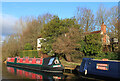
Canal Cottage
Canal boats moored on the Kennett & Avon.
Image: © Wayland Smith
Taken: 24 Dec 2020
0.01 miles
5
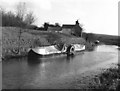
Paddle wheel propelled narrow boat, Kennet and Avon Canal
It is not unusual to encounter stern paddle wheel boats on this particular canal, but this was the only side-paddler I saw. Named 'Charlotte Dundas', it obviously would not be usable on canals with 7ft locks.
Image: © Dr Neil Clifton
Taken: 5 Feb 1977
0.02 miles
6
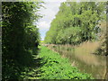
Tree lined Kennet and Avon Canal near Horton
Image: © Ian Murfitt
Taken: 7 May 2015
0.02 miles
7
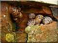
Horton - Snails
A bunch of snails hibernating in a crack in the wall of a pillbox.
Image: © Chris Talbot
Taken: 29 Dec 2011
0.03 miles
8
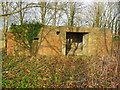
Horton - Pillbox
A large pillbox that was used to defend the Horton Chain Bridge.
Image: © Chris Talbot
Taken: 29 Dec 2011
0.03 miles
9
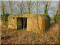
Horton - Pillbox
The entrance to this large Pillbox.
Image: © Chris Talbot
Taken: 29 Dec 2011
0.03 miles
10
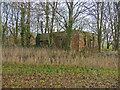
Horton - Pillbox
A large pillbox hidden among a stand of trees.
Image: © Chris Talbot
Taken: 29 Dec 2011
0.03 miles