1
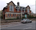
Former St Peter?s Primary School, Devizes
Viewed across Bath Road in late October 2014. Since 2012 the school has been in a new site near London Road.
Image: © Jaggery
Taken: 22 Oct 2014
0.01 miles
2
St. Peters School
From the canal towpath.
For more about the school see
Image
Image: © Des Blenkinsopp
Taken: 10 Apr 2010
0.01 miles
3
Disused school, Bath Road, Devizes
Formerly St. Peter's Church of England Primary School.
Image: © Robin Webster
Taken: 17 Mar 2018
0.01 miles
4
Devizes buildings [50]
The former main entrance to the now closed St Peter's School. Located alongside Bath Road, the school closed in 2012 following the construction of a new school.
The market town of Devizes developed around its 11th century castle. It gained a charter in 1141 and holds a weekly market in the large and picturesque Market Place. In the 16th century the town became known for its textiles and in the early 18th century held the largest corn market in the West Country. Devizes has about 500 listed buildings - a very large number for a small town.
Image: © Michael Dibb
Taken: 12 Nov 2014
0.01 miles
5
Now St Peter's House
This grand old school was closed as a school recently and is now converted into a residential property. Several old rooms are now lived in.
Image: © Neil Owen
Taken: 10 May 2024
0.01 miles
6
Devizes buildings [49]
Located alongside Bath Road, St Peter's School closed in 2012 following the construction of a new school. A planning application to convert the school building and build some 17 new houses has been lodged.
The market town of Devizes developed around its 11th century castle. It gained a charter in 1141 and holds a weekly market in the large and picturesque Market Place. In the 16th century the town became known for its textiles and in the early 18th century held the largest corn market in the West Country. Devizes has about 500 listed buildings - a very large number for a small town.
Image: © Michael Dibb
Taken: 12 Nov 2014
0.02 miles
7
Derelict school in Devizes
Awaiting renovation or demolition and re-development I assume.
Image: © Jeremy Bolwell
Taken: 17 Mar 2018
0.02 miles
8
Junction of two A roads in Devizes
The A361 Bath Road is on the left. The A342 Dunkirk Hill is on the right. In between is Shane's Castle, a small 2-storey mid 19th century stone building, Grade II listed in 1971. It used to be a toll house.
Image: © Jaggery
Taken: 22 Oct 2014
0.02 miles
9
At the end of the A342
Approaching Devizes visitors will be greeted by Shane's Castle, a former tollhouse. It was used for other purposes in its time and seems to have been occupied. The Grade II listed building was damaged by a fire in 2002 and has had a lot of work done on it to restore the integrity.
Image: © Neil Owen
Taken: 10 May 2024
0.02 miles
10
Surrounding the battlements
Shane's Castle occupies a prime spot on the approach to Devizes, as an old tollhouse would. Interestingly, details about its origin and designer are scarse, but the crenellations and overall styling are quite rare these days. Grade II listed.
Image: © Neil Owen
Taken: 10 May 2024
0.02 miles


![Devizes buildings [50]](https://s2.geograph.org.uk/geophotos/04/24/42/4244222_e7976765_120x120.jpg)

![Devizes buildings [49]](https://s3.geograph.org.uk/geophotos/04/24/42/4244203_1fd14eb1_120x120.jpg)


