1
Myrtle Farmhouse
This delightful timber-framed, thatched farmhouse was built in the 17th century. Listed, grade II, with details at: https://www.historicengland.org.uk/listing/the-list/list-entry/1243401
Image: © Michael Dibb
Taken: 21 Mar 2018
0.04 miles
2
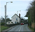
2010 : A342 passing through Rowde
Past Slades of Rowde car sales, and the parish church.
Just over a mile to Devizes.
Image: © Maurice Pullin
Taken: 21 Mar 2010
0.04 miles
3
Myrtle Farm barns
This delightful pair of thatched timber-framed barns date to the late 17th or early 18th century. Listed, grade II, with details at: https://www.historicengland.org.uk/listing/the-list/list-entry/1272905
Image: © Michael Dibb
Taken: 21 Mar 2018
0.05 miles
4
Milepost, Rowde
A lot worse preserved than the milepost a mile further north
Image, this milepost has lost its backing stone and gabled top, and is badly sunken. Distances shown are to Chippenham (8), Calne (6), and painted on top of the bevel, Devizes (2). The post directly abuts a small bridge over a stream which feeds into the Kennet & Avon Canal.
Image: © Mike Faherty
Taken: 26 Oct 2008
0.05 miles
5
Old Milepost by the A342, High Street, Rowde
Cast iron post by the A342, in parish of Rowde (Kennet District), High Street; Northwest corner of bridge, 20m North of Slades of Rowde garage, in grass, between path and metal railings adjacent to parapet end, on West side of road. Burt iron casting, erected by the Devizes (consolidated) turnpike trust in the 19th century.
Inscription reads:-
: CHIPPENᴹ / 8 : : DEVIZES / (2) : : CALNE / 6 :
Grade II listed.
List Entry Number: 1255512 https://historicengland.org.uk/listing/the-list/list-entry/1255512
Milestone Society National ID: WI_DZCP02
Image: © M Faherty
Taken: 26 Oct 2008
0.05 miles
6
Malthouse Farmhouse
The farm buildings are to the rear of the house.
Image: © Michael Dibb
Taken: 21 Mar 2018
0.05 miles
7
Langenhoe [2]
This prominent house, built circa 1850, has a delightful tent verandah. Listed, grade II, with details at: https://www.historicengland.org.uk/listing/the-list/list-entry/1272904
Image: © Michael Dibb
Taken: 21 Mar 2018
0.05 miles
8
Langenhoe [1]
This prominent house, built circa 1850, has a delightful tent verandah. Listed, grade II, with details at: https://www.historicengland.org.uk/listing/the-list/list-entry/1272904
Image: © Michael Dibb
Taken: 21 Mar 2018
0.06 miles
9
Prospect House
Built circa 1830, this brick built house is prominently sited with a view down High Street. Listed, grade II, with details at: https://www.historicengland.org.uk/listing/the-list/list-entry/1243402
Image: © Michael Dibb
Taken: 21 Mar 2018
0.07 miles
10
2010 : A342 leaving Rowde
After a short visit, heading north for Derry Hill and Chippenham.
Image: © Maurice Pullin
Taken: 21 Mar 2010
0.07 miles


![Langenhoe [2]](https://s0.geograph.org.uk/geophotos/05/72/08/5720824_ba8c4e77_120x120.jpg)
![Langenhoe [1]](https://s3.geograph.org.uk/geophotos/05/72/08/5720823_4c08c1c8_120x120.jpg)

