IMAGES TAKEN NEAR TO
Rowdefield, DEVIZES, SN10 2JF

Introduction

This page details the photographs taken nearby to SN10 2JF by members of the Geograph project.

The Geograph project started in 2005 with the aim of publishing, organising and preserving representative images for every square kilometre of Great Britain, Ireland and the Isle of Man.

There are currently over 7.5m images from over14,400 individuals and you can help contribute to the project by visiting https://www.geograph.org.uk

Image Map


Images are licensed for reuse under creativecommons.org/licenses/by-sa/2.0
Notes
  • Clicking on the map will re-center to the selected point.
  • The higher the marker number, the further away the image location is from the centre of the postcode.

Image Listing (16 Images Found)

Images are licensed for reuse under creativecommons.org/licenses/by-sa/2.0
Image
Details
Distance
1
Field of brassica
Seen from the path the view across the field takes in Rowde Field Farm Cottages and the farm buildings.
Image: © Michael Dibb Taken: 6 Nov 2016
0.01 miles
2
Rowde Field Farm Cottages
The cottages are located in the wonderfully named Consciences Lane.
Image: © Michael Dibb Taken: 19 Nov 2014
0.01 miles
3
2009 : Approaching Iron Pear Tree Farm on Consciences Lane
Looking for tractor drivers apparently.
Image: © Maurice Pullin Taken: 1 Jun 2009
0.03 miles
4
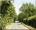
2009 : Looking east on Consciences Lane
Rowde Field Farm is round the next bend.
Image: © Maurice Pullin Taken: 1 Jun 2009
0.06 miles
5
Iron Peartree Farm
This wonderfully named farm is seen from the footpath.
Image: © Michael Dibb Taken: 19 Nov 2014
0.10 miles
6
Footpath near Rowde
The footpath, which is a wide headland at this point, follows the watercourse.
Image: © Maigheach-gheal Taken: 1 Jan 2011
0.12 miles
7
Mixed animals
In the field alongside the path were goats, sheep and chickens. The buildings are part of Rowde Field Farm.
Image: © Michael Dibb Taken: 19 Nov 2014
0.13 miles
8
Path leaves the road
From Consciences Lane, this footpath runs to Bromham.
Image: © Michael Dibb Taken: 19 Nov 2014
0.13 miles
9
Path leaves the road
The track, a public footpath, leaves Conscience Lane.
Image: © Michael Dibb Taken: 6 Nov 2016
0.13 miles
10
2009 : Field north of Consciences Lane
The crop appears to be barley or wheat. Beacon Hill is in the distance to the left and Oliver's Castle with its trees on top to the right. Image
Image: © Maurice Pullin Taken: 1 Jun 2009
0.15 miles