1
2012 : Urban creep on the edge of Devizes
Very recent urban creep and quite pleasant but still urban creep. So recent it does not yet figure on Where's the Path. You take the first turning past the police station on the A361 north of Devizes.
Image: © Maurice Pullin
Taken: 11 May 2012
0.04 miles
2
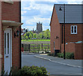
2012 : Between the houses, Devizes
On a modern housing estate north of town, the parish church is seen through the gap.
Image: © Maurice Pullin
Taken: 11 May 2012
0.04 miles
3
2012 : New housing on the edge of Devizes
West of Brickham Bridge.
I hesitate to call this an estate, though it obviously is, the mix of styles has been skillfully handled so some but not too many have a similar appearance.
Image: © Maurice Pullin
Taken: 11 May 2012
0.06 miles
4
Quakers Walk housing development
Seen from Quakers Walk footpath this recent development is on what was previously open space. Urban creep.
Image: © Michael Dibb
Taken: 14 Nov 2014
0.06 miles
5
2012 : Builders on the job, Devizes
A modern housing development north of Devizes, the street cleaner is doing his rounds already, there's keen.
<>
All housing developments are modern when they are being built.
Image: © Maurice Pullin
Taken: 11 May 2012
0.06 miles
6
2012 : Modern housing north of Devizes
So modern the builders are still there and it isn't on the map yet. Congratulations to all concerned for the appearance of the houses, smart, good variation, good layout - it can be done.
Image: © Maurice Pullin
Taken: 11 May 2012
0.06 miles
7
Quakers' Walk, Devizes
A white tailed bumble bee on common comfrey flowers.
Image: © Rebecca A Wills
Taken: 19 Jun 2022
0.06 miles
8
Devizes features [17]
The play area is located within the Quakers Walk housing estate.
The market town of Devizes developed around its 11th century castle. It gained a charter in 1141 and holds a weekly market in the large and picturesque Market Place. In the 16th century the town became known for its textiles and in the early 18th century held the largest corn market in the West Country. Devizes has about 500 listed buildings - a very large number for a small town.
Image: © Michael Dibb
Taken: 14 Nov 2014
0.08 miles
9
Quakers' Walk
Avenue of trees guard this footpath that leads from the Kennet and Avon Canal in Devizes towards Roundway. It has also been adapted by the Wessex Ridgeway.
Image: © Chris Heaton
Taken: 28 Apr 2007
0.09 miles
10
Quakers Walk through New Park
New Park was established as a deer park in 1157, and this path has been a public right of way for at least 200 years http://www.trustfordevizes.info/quakers_walk
Image: © Tim Heaton
Taken: 7 Feb 2018
0.10 miles


![Devizes features [17]](https://s3.geograph.org.uk/geophotos/04/24/58/4245871_0402282a_120x120.jpg)

