1
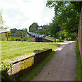
Looking up Caen Hill locks in 1985
Restoration was underway
Image: © John Baker
Taken: 15 Mar 1985
0.08 miles
2
Part way up the Caen Hill Flight of locks
When the architect and engineer John Rennie recommended routing the Kennet & Avon Canal through Devizes on the way to Bath he had to overcome a major obstacle at Devizes where the high ground of the Vale of Pewsey drops 237 feet towards the Avon Valley within two and a half miles. The Caen Hill Flight was the result which forms part of the Devizes Flight of 29 locks and is one of the Seven Wonders of the Waterways – see https://canalrivertrust.org.uk/enjoy-the-waterways/canal-history/history-features-and-articles/the-seven-wonders-of-the-waterways?gclid=EAIaIQobChMI-sGZ1LrL4AIVjZXtCh2LTAsBEAAYASAAEgIv6PD_BwE
Caen Hill Flight was the last stretch of the Kennet & Avon Canal to be completed in 1810 and after almost being abandoned after 1955 has now been fully restored.
This is part way up the Caen Hill Flight. The white house in the far distance is where the canal bends to pass under Marsh Lane.
Image: © Marathon
Taken: 13 Feb 2019
0.08 miles
3
The Caen Hill Flight of locks
When the architect and engineer John Rennie recommended routing the Kennet & Avon Canal through Devizes on the way to Bath he had to overcome a major obstacle at Devizes where the high ground of the Vale of Pewsey drops 237 feet towards the Avon Valley within two and a half miles. The Caen Hill Flight was the result which forms part of the Devizes Flight of 29 locks and is one of the Seven Wonders of the Waterways – see https://canalrivertrust.org.uk/enjoy-the-waterways/canal-history/history-features-and-articles/the-seven-wonders-of-the-waterways?gclid=EAIaIQobChMI-sGZ1LrL4AIVjZXtCh2LTAsBEAAYASAAEgIv6PD_BwE
Caen Hill Flight was the last stretch of the Kennet & Avon Canal to be completed in 1810 and after almost being abandoned after 1955 has now been fully restored.
This is part way up the Caen Hill Flight. The white house in the far distance is where the canal bends to pass under Marsh Lane.
Image: © Marathon
Taken: 13 Feb 2019
0.08 miles
4
Lock 31 at Caen Hill
Image: © David Smith
Taken: 8 Jun 2017
0.09 miles
5
Kennet and Avon canal towpath
Adjacent to the lower lock on the Kennet and Avon canal. 16 locks of the Caen Hill flight can be seen in the distance.
Image: © Roger Gittins
Taken: 21 May 2009
0.09 miles
6
Working up the Caen Hill flight, Kennet & Avon Canal
Filling a lock with a boat in it. The man in a hi-vis vest is a volunteer from the Canal & River Trust team, who help boaters with the locks, if required.
Image: © Christine Johnstone
Taken: 6 May 2015
0.09 miles
7
Rowde, lock No 32
Descending Caen Hill; note the side pool, right. http://www.wiltshiretouristguide.com/Articles/Article_157.asp
Image: © Mike Faherty
Taken: 9 Jan 2016
0.09 miles
8
Lock 32, Kennet and Avon Canal
Part way up the Caen Hill flight.
Image: © Robin Webster
Taken: 21 Aug 2016
0.09 miles
9
Caen Hill Locks [34]
Seen from above, this is lock number 32.
There are 29 locks raising the Kennet and Avon Canal 272 feet in a distance of two miles up Caen Hill near Devizes. Designed by engineer John Rennie, the sixteen locks (numbers 29 to 44) which form the steepest part are a Scheduled Ancient Monument.
Image: © Michael Dibb
Taken: 30 Jan 2018
0.09 miles
10
Caen Hill Farm
The farm is seen from the driveway. The embankment on either side of the driveway once carried the Devizes Branch railway and access to the farm was through tunnel under the embankment. Since the closure of the railway in 1966 the embankment has been cut back.
Image: © Michael Dibb
Taken: 8 Dec 2014
0.09 miles


![Caen Hill Locks [34]](https://s0.geograph.org.uk/geophotos/05/68/18/5681828_53965787_120x120.jpg)
