1
Houses on Bath Road, Devizes
Image: © David Howard
Taken: 21 Aug 2016
0.02 miles
2
Mayenne Place
Image: © Anthony Parkes
Taken: 2 Aug 2021
0.03 miles
3
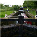
Devizes - Caen Hill Lock
Narrowboats moored at the top of this flight of locks.
Built in 1810 this flight of 16 successive locks is one of the most impressive on the UK’s waterways and forms part of the Devizes flight of 29 locks. They are designated as a Scheduled Ancient Monument – the same level of heritage protection given to Stonehenge.
Image: © Chris Talbot
Taken: 29 Dec 2011
0.05 miles
4
Houses on Bath Road, Devizes
Image: © David Howard
Taken: 21 Aug 2016
0.06 miles
5
Pumping station
This pumping station is at the end of Avon Road.
Image: © Michael Dibb
Taken: 8 Dec 2014
0.08 miles
6
Caen Hill Locks on the Kennet & Avon Canal
Image: © Steve Daniels
Taken: 2 May 2010
0.09 miles
7
Old Milepost by the A365, Bath Road, Devizes parish
Cast iron post by the A365, in parish of DEVIZES (KENNET District), Bath Road, by "Fairmile", West of Dunkirk Hill, in pavement with back to brick garden wall, on South side of road. Burt iron casting, erected by the Devizes (consolidated) turnpike trust in the 19th century.
Inscription reads:-
: BATH / 20 : : LONDON / 90 : : DEVIZES / 1 :
Milestone Society National ID: WI_LB_BADZ20.
Image: © A Rosevear
Taken: 20 Oct 2003
0.09 miles
8
Old Milepost by the A365, Bath Road, Devizes parish
Cast iron post by the A365, in parish of DEVIZES (KENNET District), Bath Road, by "Fairmile", West of Dunkirk Hill, in pavement with back to brick garden wall, on South side of road. Burt iron casting, erected by the Devizes (consolidated) turnpike trust in the 19th century. An earlier photograph can be found here https://www.geograph.org.uk/photo/6072545.
Inscription reads:-
: BATH / 20 : : LONDON / 90 : : DEVIZES / 1 :
Milestone Society National ID: WI_LB_BADZ20
Image: © Gail Fawcett
Taken: 31 Jul 2023
0.09 miles
9
Start of path
The footpath sign (attached to the lamppost) points the way down the side of the hedge. Seen from Avon Road.
Image: © Michael Dibb
Taken: 8 Dec 2014
0.09 miles
10
Going down
A narrowboat negotiates a lock towards the top-end of the Caen Hill flight.
Image: © Roger Gittins
Taken: 21 May 2009
0.10 miles


