1
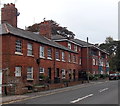
Sedgefield Gardens, Devizes
On the east side of Commercial Road.
Image: © Jaggery
Taken: 22 Oct 2014
0.02 miles
2
Devizes ways [7]
This narrow and little used public footpath runs at the back of houses in Victoria Street.
The market town of Devizes developed around its 11th century castle. It gained a charter in 1141 and holds a weekly market in the large and picturesque Market Place. In the 16th century the town became known for its textiles and in the early 18th century held the largest corn market in the West Country. Devizes has about 500 listed buildings - a very large number for a small town.
Image: © Michael Dibb
Taken: 18 Nov 2014
0.04 miles
3
Churchyard, St Mary's Church, Devizes
There are many old and interesting tombs and monuments within the churchyard. The church is no longer used for regular worship and consultations are ongoing to consider community use.
Image: © Maigheach-gheal
Taken: 1 Jan 2011
0.05 miles
4
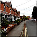
Houses at the SW end of Commercial Road, Devizes
Viewed from the A361 junction.
Image: © Jaggery
Taken: 22 Oct 2014
0.05 miles
5
Commercial Road houses, Devizes
In the second decade of the 21st century, there are no shops or other commercial premises in this part of Commercial Road, presumably named at a time when things were otherwise.
Image: © Jaggery
Taken: 22 Oct 2014
0.05 miles
6
United Oilseeds office in Devizes
St James House, Gains Lane. United Oilseeds Marketing Ltd is the UK's only specialised oilseed rape marketing company. The company has two key functions - marketing oilseed crops and seed sale.
Image: © Jaggery
Taken: 22 Oct 2014
0.05 miles
7
Commercial Road, Devizes
Looking SE from the corner of New Park Road.
Image: © Jaggery
Taken: 22 Oct 2014
0.06 miles
8
Devizes houses [45]
St Mary's Almshouses are on Victoria Road. These attractive almshouses were refurbished and extended in 2002.
The market town of Devizes developed around its 11th century castle. It gained a charter in 1141 and holds a weekly market in the large and picturesque Market Place. In the 16th century the town became known for its textiles and in the early 18th century held the largest corn market in the West Country. Devizes has about 500 listed buildings - a very large number for a small town.
Image: © Michael Dibb
Taken: 18 Nov 2014
0.06 miles
9
Church of St Mary [1]
The church has Norman origins but was mostly rebuilt in the 15th century with a fine, large and dominating tower Listed, grade I, with details at: https://historicengland.org.uk/listing/the-list/list-entry/1251640
The market town of Devizes developed around its 11th century castle. It gained a charter in 1141 and holds a weekly market in the large and picturesque Market Place. In the 16th century the town became known for its textiles and in the early 18th century held the largest corn market in the West Country. Devizes has about 500 listed buildings - a very large number for a small town.
Image: © Michael Dibb
Taken: 18 Nov 2014
0.06 miles
10
Row of houses at the SE end of Commercial Road, Devizes
Viewed from the edge of the A361 Gains Lane.
Image: © Jaggery
Taken: 22 Oct 2014
0.07 miles


![Devizes ways [7]](https://s0.geograph.org.uk/geophotos/04/25/09/4250996_c22a4fbd_120x120.jpg)


![Devizes houses [45]](https://s0.geograph.org.uk/geophotos/04/25/09/4250968_727ad8ef_120x120.jpg)
![Church of St Mary [1]](https://s1.geograph.org.uk/geophotos/04/24/99/4249905_9085506a_120x120.jpg)
