IMAGES TAKEN NEAR TO
Upper Pines, BANSTEAD, SM7 3PU
Introduction
This page details the photographs taken nearby to Upper Pines, SM7 3PU by members of the Geograph project.
The Geograph project started in 2005 with the aim of publishing, organising and preserving representative images for every square kilometre of Great Britain, Ireland and the Isle of Man.

There are currently over 7.5m images from over14,400 individuals and you can help contribute to the project by visiting https://www.geograph.org.uk
Image Map (Loading...)


Getting Data...Please wait
Leaflet Map data © OpenStreetMap
Images are licensed for reuse under creativecommons.org/licenses/by-sa/2.0
Notes
- Clicking on the map will re-center to the selected point.
- The higher the marker number, the further away the image location is from the centre of the postcode.
Image Listing (22 Images Found)
Images are licensed for reuse under creativecommons.org/licenses/by-sa/2.0
Image
Details
Distance

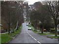
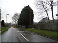
3
Chipstead Way - Steep Hill 12%
Chipstead Way, Woodmansterne. 12% steep hill down sign.
Image: © Adam Morse
Taken: 7 Jun 2009
0.10 miles
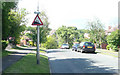
4
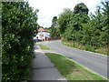
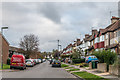
Manor Way, Woodmansterne
Manor Way is a residential road in Woodmansterne, in Surrey.
Image: © Malc McDonald
Taken: 19 Feb 2023
0.11 miles
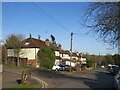
6
Rectory Lane, Woodmansterne
This is towards the outskirts of Woodmansterne. Manor Way is just ahead on the left.
Image: © Marathon
Taken: 14 Aug 2013
0.15 miles
8
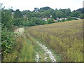
Path alongside Rectory Lane
This field is next to Rectory Lane and here is looking towards the outskirts of Woodmansterne.
Image: © Marathon
Taken: 14 Aug 2013
0.17 miles
9
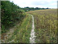
Path alongside Rectory Lane
This field is next to Rectory Lane and here is looking towards the outskirts of Woodmansterne. This is not an official footpath but is clearly well used.
Image: © Marathon
Taken: 14 Aug 2013
0.17 miles
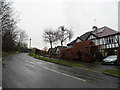
10
Lakers Rise
Cul-de-sac off Chipstead Way, absent from the 1935 1:2,500 map but marked in outline on the 1938 1:10,560 map. The right hand side saw the initial development, the left hand side being built up much later.
Image: © Ian Capper
Taken: 27 Oct 2018
0.18 miles