
IMAGES TAKEN NEAR TO
Whelan Way, WALLINGTON, SM6 7NF
Introduction
This page details the photographs taken nearby to Whelan Way, SM6 7NF by members of the Geograph project.
The Geograph project started in 2005 with the aim of publishing, organising and preserving representative images for every square kilometre of Great Britain, Ireland and the Isle of Man.

There are currently over 7.5m images from over14,400 individuals and you can help contribute to the project by visiting https://www.geograph.org.uk
Image Map
Images are licensed for reuse under creativecommons.org/licenses/by-sa/2.0
Notes
- Clicking on the map will re-center to the selected point.
- The higher the marker number, the further away the image location is from the centre of the postcode.
Image Listing (224 Images Found)
Images are licensed for reuse under creativecommons.org/licenses/by-sa/2.0
Image
Details
Distance
1
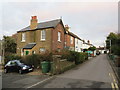
Church Lane, Beddington
Houses on Church lane in Beddington, in the outer suburbs of south London.
Image: © Malc McDonald
Taken: 4 Jan 2020
0.05 miles
2
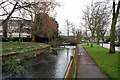
Beddington: River Wandle
Looking east towards the confluence of the mill stream
Image: © Dr Neil Clifton
Taken: 31 Mar 2010
0.05 miles
3
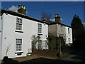
Cottages in Church Lane, Beddington
I have often admired these Victorian cottages, but this was the first occasion on which I stopped to take a photograph.
Image: © Peter Trimming
Taken: 2 Mar 2009
0.06 miles
4
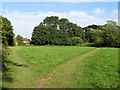
Diverging paths
The path to the right is the Wandle Trail towards Croydon; the one to the left leads to Mallinson Road.
Image: © Stephen Craven
Taken: 19 Aug 2012
0.06 miles
5
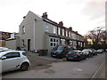
Church Lane, Beddington
A housing terrace on Church Lane in Beddington, in the outer suburbs of south London.
Image: © Malc McDonald
Taken: 4 Jan 2020
0.06 miles
6
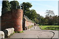
Church Lane, Beddington, Surrey
This quiet lane runs along the side of St. Mary's Church, and thankfully, is closed to motor traffic.
Image: © Dr Neil Clifton
Taken: 18 Oct 2007
0.06 miles
7

Beddington: River Wandle
Looking north. The river, after following a westerly course for miles, has a short northerly section here, and descends a small weir, the top of which can just be seen in the photograph.
Image: © Dr Neil Clifton
Taken: 5 Apr 2010
0.06 miles
9

Beddington: The Wandle Trail
After the Wandle has resumed its westward course, the path swings away to the north to avoid crossing private ground. In this picture, the river is behind me and the northward path is seen swinging round to the right.
Image: © Dr Neil Clifton
Taken: 5 Apr 2010
0.06 miles
10
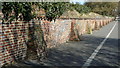
Wall in Church Lane, Beddington
This old wall, complete with buttresses to contain the bulges, stands alongside the shared foot/cycle path.
Image: © Peter Trimming
Taken: 2 Mar 2009
0.07 miles