
IMAGES TAKEN NEAR TO
Angora Close, WALLINGTON, SM6 7DY
Introduction
This page details the photographs taken nearby to Angora Close, SM6 7DY by members of the Geograph project.
The Geograph project started in 2005 with the aim of publishing, organising and preserving representative images for every square kilometre of Great Britain, Ireland and the Isle of Man.

There are currently over 7.5m images from over14,400 individuals and you can help contribute to the project by visiting https://www.geograph.org.uk
Image Map
Images are licensed for reuse under creativecommons.org/licenses/by-sa/2.0
Notes
- Clicking on the map will re-center to the selected point.
- The higher the marker number, the further away the image location is from the centre of the postcode.
Image Listing (88 Images Found)
Images are licensed for reuse under creativecommons.org/licenses/by-sa/2.0
Image
Details
Distance
1
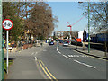
Hackbridge Road (B277)
Looking north of Hack Bridge over the River Wandle.
Image: © Robin Webster
Taken: 28 Mar 2012
0.03 miles
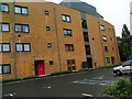
3
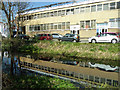
Wandle reflections, Hackbridge
Units at Sutton Business Park are partly reflected in the River Wandle.
Image: © Robin Webster
Taken: 28 Mar 2012
0.05 miles
4
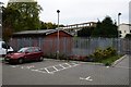
Hackbridge: Corbet Close 8
The car park for the flats fronting Hackbridge Road and the disused and sold Cadet Centre.
Image: © Michael Garlick
Taken: 7 Nov 2013
0.06 miles
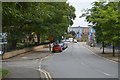
6
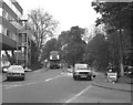
The Hack Bridge on the B277
The bridge seen here under repair is on a very old route from Carshalton to London. Known as the Hack Bridge, it crosses the River Wandle, and it has given its name to a whole suburban area, including a station.
A Routemaster bus on Route 77 is seen crossing the bridge.
Image: © Dr Neil Clifton
Taken: 21 Apr 1981
0.06 miles
7
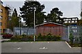
Hackbridge: Corbet Close 7
Taken from the far corner of the car park this shows to best effect the high metal fence surrounding the Hackbridge Cadet Centre.
Image: © Michael Garlick
Taken: 7 Nov 2013
0.06 miles
8
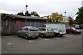
Hackbridge: Corbet Close 6
The car park for the flats fronting Hackbridge Road and the disused Cadet Centre.
Image: © Michael Garlick
Taken: 7 Nov 2013
0.06 miles
9
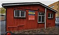
Hackbridge: Corbet Close 10
Detail of the disused Hackbridge Cadet Centre.
Image: © Michael Garlick
Taken: 7 Nov 2013
0.06 miles
10
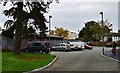
Hackbridge: Corbet Close 5
The car park for the flats fronting Hackbridge Road with the disused Cadet Centre.
Image: © Michael Garlick
Taken: 7 Nov 2013
0.06 miles