
IMAGES TAKEN NEAR TO
Balfour Road, CARSHALTON, SM5 4NL
Introduction
This page details the photographs taken nearby to Balfour Road, SM5 4NL by members of the Geograph project.
The Geograph project started in 2005 with the aim of publishing, organising and preserving representative images for every square kilometre of Great Britain, Ireland and the Isle of Man.

There are currently over 7.5m images from over14,400 individuals and you can help contribute to the project by visiting https://www.geograph.org.uk
Image Map
Images are licensed for reuse under creativecommons.org/licenses/by-sa/2.0
Notes
- Clicking on the map will re-center to the selected point.
- The higher the marker number, the further away the image location is from the centre of the postcode.
Image Listing (54 Images Found)
Images are licensed for reuse under creativecommons.org/licenses/by-sa/2.0
Image
Details
Distance
1
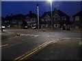
Stanley Park Road at the junction of Balfour Road
Image: © David Howard
Taken: 24 Jan 2016
0.03 miles
2
Path off Stanley Park Gardens, Carshalton
Image: © David Howard
Taken: 24 Jan 2016
0.03 miles
3
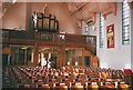
Church of the Good Shepherd, Interior
The interior of Image
Image: © Stephen Craven
Taken: 18 Sep 2003
0.03 miles
4
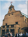
Church of the Good Shepherd, Carshalton Beeches
A Grade II listed Anglican church, built in 1930 by Martin Travers and T F W Grant, and often described as being in the 'Spanish mission' style. It was extended in the early years of the present century to offer community facilities.
Image: © Stephen Craven
Taken: 18 Sep 2003
0.04 miles
5
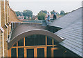
Roof of the Good Shepherd church
This unusual view, taken on an architectural tour, shows the wall of the 1930 church building at left, and the curved and pitched roofs of the extension (c.1991).
Image: © Stephen Craven
Taken: 18 Sep 2003
0.04 miles
6
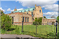
Church of the Good Shepherd
Church on Queen Mary's Avenue, built 1929-30 and designed by Martin Travers in "Spanish colonial" style. It replaced a "tin tabernacle" mission church on Stanley Park Road situated where a shopping parade now stands (see Image). Side extensions have subsequently been added both south (in 2001) and north (in 2011) of the main church. Grade II listed - see https://historicengland.org.uk/listing/the-list/list-entry/1253568?section=official-list-entry.
Image: © Ian Capper
Taken: 25 Apr 2023
0.04 miles
8
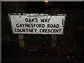
Footpath sign by Stanley Park Road, Carshalton
Image: © David Howard
Taken: 24 Jan 2016
0.05 miles
9
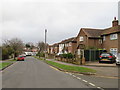
Gaynesford Road, Carshalton
Gaynesford Road is a residential road in Carshalton, in the outer suburbs of south London.
Image: © Malc McDonald
Taken: 11 Jan 2020
0.05 miles
10
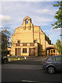
Church of the Good Shepherd, Carshalton
Built in a Spanish Mission style in 1930 to serve expanding suburbia.
Image: © Christopher Hilton
Taken: 4 Jul 2014
0.07 miles