
IMAGES TAKEN NEAR TO
Sunnymede Avenue, CARSHALTON, SM5 4JA
Introduction
This page details the photographs taken nearby to Sunnymede Avenue, SM5 4JA by members of the Geograph project.
The Geograph project started in 2005 with the aim of publishing, organising and preserving representative images for every square kilometre of Great Britain, Ireland and the Isle of Man.

There are currently over 7.5m images from over14,400 individuals and you can help contribute to the project by visiting https://www.geograph.org.uk
Image Map
Images are licensed for reuse under creativecommons.org/licenses/by-sa/2.0
Notes
- Clicking on the map will re-center to the selected point.
- The higher the marker number, the further away the image location is from the centre of the postcode.
Image Listing (25 Images Found)
Images are licensed for reuse under creativecommons.org/licenses/by-sa/2.0
Image
Details
Distance
3
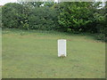
Banstead Hospital Cemetery
This cemetery is now closed. Most burials do not have headstones. There is one CWGC burial. Grave ref. 396M Sapper 21227 Reginald Adolphus MOYSE Royal Engineers. Died of wounds 28 Apr 1917. The cemetery is now enclosed in a livery yard,with horses allowed to graze, which keeps the grass short.
Image: © The Saunterer
Taken: 24 Apr 2014
0.12 miles
4

Banstead Hospital Cemetery
Close-up of CWGC burial Sapper 21227 R.E. MOYSE Royal Engineers Died 28 Apr 1917.
Image: © The Saunterer
Taken: 24 Apr 2014
0.12 miles
5

Fairlawn Road, Belmont
The road sign says "Unsuitable for Motor Vehicles"
Image: © Noel Foster
Taken: 13 Sep 2005
0.14 miles
6

Oak Park golf course.
As seen from Fairlawn Road.
Image: © Noel Foster
Taken: 13 Sep 2005
0.14 miles
7
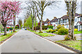
Fairway
Road of semi-detached houses first marked on the 1935 25 inch map. At the far end of the road is the Surrey/London Borough of Sutton boundary.
Image: © Ian Capper
Taken: 26 Apr 2023
0.14 miles
8
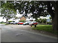
Houses on Fairlawn Road, Carshalton
Fairlawn Road forms the border between the London Borough of Sutton and Surrey.
Image: © David Howard
Taken: 15 Jun 2014
0.16 miles
9
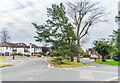
Junction of Fairway and Pine Walk
Junction of two residential roads first marked on the 1935 25 inch map. On the far left of the photo is the pillar box in Image
Image: © Ian Capper
Taken: 26 Apr 2023
0.17 miles
10
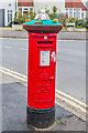
Pillar box, Junction of Fairway and Pine Walk
George V pillar box adorned with an Easter themed knitted topper, situated at the junction of two residential roads first marked on the 1935 25 inch map. For a wider view see Image
Image: © Ian Capper
Taken: 26 Apr 2023
0.17 miles