
IMAGES TAKEN NEAR TO
Wrythe Lane, CARSHALTON, SM5 2QU
Introduction
This page details the photographs taken nearby to Wrythe Lane, SM5 2QU by members of the Geograph project.
The Geograph project started in 2005 with the aim of publishing, organising and preserving representative images for every square kilometre of Great Britain, Ireland and the Isle of Man.

There are currently over 7.5m images from over14,400 individuals and you can help contribute to the project by visiting https://www.geograph.org.uk
Image Map
Images are licensed for reuse under creativecommons.org/licenses/by-sa/2.0
Notes
- Clicking on the map will re-center to the selected point.
- The higher the marker number, the further away the image location is from the centre of the postcode.
Image Listing (106 Images Found)
Images are licensed for reuse under creativecommons.org/licenses/by-sa/2.0
Image
Details
Distance
2
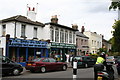
Wrythe Green Newsagents, Carshalton
In fact, a general shop. The ornate frontage on the upper storey suggests that it may once have been a cafe. The motorcyclist, armed with digital camera, is there to target illegal parkers.
Image: © Dr Neil Clifton
Taken: 5 Jul 2007
0.03 miles
3
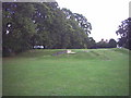
Air raid shelters, Wrythe Recreation Ground, Carshalton.
Next to Carshalton Girls' High School.
Image: © Noel Foster
Taken: 2 Sep 2005
0.05 miles
5
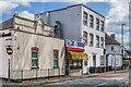
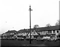
King's Parade
Row of buildings on Wrythe Lane, with nos 4 - 5, the taller block towards the right of the photo, named Cumberland Court. The ornate section behind the current façade on the left of the photo is marked on the 1871 6 inch map and was a pub, the Rose Inn, which closed in 1912 when its licence wasn't renewed.
Image: © Ian Capper
Taken: 25 Apr 2023
0.08 miles
6
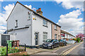
William Street
Road marked on the 1871 6 inch map as "Private Street" with the current name shown on the 1896 25 inch map. These maps show the housing as long terraces, since redeveloped.
Image: © Ian Capper
Taken: 25 Apr 2023
0.09 miles
7
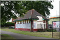
Disused toilet block, Wrythe Recreation Ground, Carshalton
One sees this sort of thing far too often. Clearly the toilets were taken out of use because of continuing vandalism by the kind of brainless young moron that is frequently at large in our towns and cities. Surely the answer should be to provide an attendant, levy a meaningful charge, and when vandalism does occur, see that the miscreants are severely punished to deter both them and others from committing the same kind of offence again. Just abandoning costly facilities is not the answer.
Image: © Dr Neil Clifton
Taken: 5 Jul 2007
0.10 miles
8
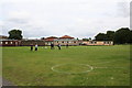
Sports fields, Carshalton High School for Girls
Carshalton High School is a large comprehensive girls' school opposite Wrythe Green.
Image: © Dr Neil Clifton
Taken: 5 Jul 2007
0.10 miles
10
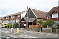
West Street Evangelical Church, Carshalton, Surrey
Perhaps an evangelical church is necessary in Carshalton as a kind of counter-balance to the very large number of public houses...
Image: © Dr Neil Clifton
Taken: 5 Jul 2007
0.11 miles