
IMAGES TAKEN NEAR TO
Alma Road, CARSHALTON, SM5 2PF
Introduction
This page details the photographs taken nearby to Alma Road, SM5 2PF by members of the Geograph project.
The Geograph project started in 2005 with the aim of publishing, organising and preserving representative images for every square kilometre of Great Britain, Ireland and the Isle of Man.

There are currently over 7.5m images from over14,400 individuals and you can help contribute to the project by visiting https://www.geograph.org.uk
Image Map
Images are licensed for reuse under creativecommons.org/licenses/by-sa/2.0
Notes
- Clicking on the map will re-center to the selected point.
- The higher the marker number, the further away the image location is from the centre of the postcode.
Image Listing (51 Images Found)
Images are licensed for reuse under creativecommons.org/licenses/by-sa/2.0
Image
Details
Distance
1
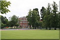
St. Philomena's School, Carshalton
This photograph shows just part of the school and its grounds. The school occupies the grounds of Carshalton House, an historic building. It is a large Roman Catholic girls' senior school, and is very highly regarded for its excellent academic results - and also, incidentally, for the very good behaviour in public of its students.
Image: © Dr Neil Clifton
Taken: 5 Jul 2007
0.10 miles
2
Carshalton House
Grade II* listed. https://www.britishlistedbuildings.co.uk/101065627-carshalton-house-carshalton-central-ward
Image: © N Chadwick
Taken: 23 Aug 2017
0.11 miles
3
Pedestrian crossing on Carshalton Road
The light is red but where are the pedestrians?
Image: © David Howard
Taken: 3 Aug 2014
0.11 miles
4
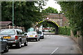
Railway bridge over Shorts Road, Carshalton, Surrey
This bridge carries the ex-LBSCR railway line between Mitcham Junction and Sutton. Beyond the bridge, Shorts Road forms a T-junction with Westmead Road (on the left) and Colston Avenue (on the right). Behind the photographer, Shorts Road runs down to a junction with the A232, Carshalton Road.
Image: © Dr Neil Clifton
Taken: 5 Jul 2007
0.13 miles
5
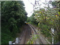
Railway line in Carshalton
The train heading north from the bridge on Carshalton Road
Image: © David Howard
Taken: 19 Jul 2009
0.14 miles
6
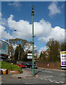
Carshalton: Ornamental sewer vent pipe
This well preserved example is just near the railway bridge at the junction of Harrow Road with Carshalton Road.
Image: © Dr Neil Clifton
Taken: 15 Apr 2012
0.15 miles
8
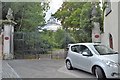
Gates to Carshalton House
Grade II listed. https://www.britishlistedbuildings.co.uk/101357607-gate-piers-and-gates-at-carshalton-house-carshalton-central-ward
Image: © N Chadwick
Taken: 23 Aug 2017
0.15 miles
9
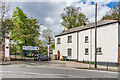
Lodge and gates to Carshalton House
Lodge and gates to Carshalton House (now a school) off Pound Street. The gates date from the early 18th Century and are grade II listed - see https://historicengland.org.uk/listing/the-list/list-entry/1357607?section=official-list-entry.
Image: © Ian Capper
Taken: 25 Apr 2023
0.15 miles
10
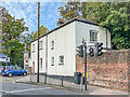
Lodge to Carshalton House
Lodge to Carshalton House (now a school) off Pound Street.
Image: © Ian Capper
Taken: 7 Oct 2022
0.16 miles