
IMAGES TAKEN NEAR TO
North Street, CARSHALTON, SM5 2JD
Introduction
This page details the photographs taken nearby to North Street, SM5 2JD by members of the Geograph project.
The Geograph project started in 2005 with the aim of publishing, organising and preserving representative images for every square kilometre of Great Britain, Ireland and the Isle of Man.

There are currently over 7.5m images from over14,400 individuals and you can help contribute to the project by visiting https://www.geograph.org.uk
Image Map
Images are licensed for reuse under creativecommons.org/licenses/by-sa/2.0
Notes
- Clicking on the map will re-center to the selected point.
- The higher the marker number, the further away the image location is from the centre of the postcode.
Image Listing (308 Images Found)
Images are licensed for reuse under creativecommons.org/licenses/by-sa/2.0
Image
Details
Distance
3
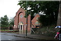
Roman Catholic church, North Street, Carshalton, Surrey
The shelter of the railway bridge was necessary to procure this image, on a day when Wimbledon was confidently expected to go into a third week.
Image: © Dr Neil Clifton
Taken: 4 Jul 2007
0.04 miles
4

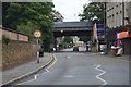
Railway bridge over North Street, Carshalton
This girder bridge is seen here from the south side.
Image: © Dr Neil Clifton
Taken: 4 Jul 2007
0.04 miles
5
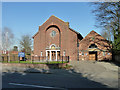
Holy Cross Catholic Church, Carshalton
On North Street.
Image: © Robin Webster
Taken: 28 Mar 2012
0.04 miles
6

Carshalton station
The Peckham Rye to Sutton line via Streatham opened in 1868 by the London, Brighton & South Coast Railway at which date Carshalton station was also opened. Prior to 1868 what is now Wallington station was called Carshalton. The railway building on the right though would seem to date from 1902 as that is the date on the outside - see http://en.wikipedia.org/wiki/File:Carshalton_Station.jpg This view is from the down platform, looking in the direction of Hackbridge.
Image: © Marathon
Taken: 13 Jun 2012
0.04 miles
7
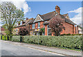
22 - 24 Rochester Road
Road shown partly developed on the 1896 25 inch map. The 1913 edition shows the north side of this section as being a hospital, the nearest house here (now nos 22 - 24) being the original section, opened in 1899 as Carshalton Cottage Hospital. Later maps mark it as an "institution". Subsequent uses included a day nursery, a clinic and a GP surgery. In 2002 it was converted and extended into three residences with the remainder of the site (beyond on the left) being redeveloped as Morgan Court.
Image: © Ian Capper
Taken: 25 Apr 2023
0.04 miles
8
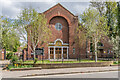
Holy Cross Church
Roman Catholic church on North Street opened in 1932 on the site of chapel which had been used by the local Roman Catholic congregation since 1914 (prior to which it had been used by the Methodists for around 50 years from 1861 and then the Salvation Army).
Image: © Ian Capper
Taken: 25 Apr 2023
0.04 miles
9
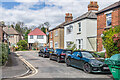
Rochester Road
Road shown partly developed on the 1896 25 inch map, including the houses on the right here.
Image: © Ian Capper
Taken: 25 Apr 2023
0.04 miles
