
IMAGES TAKEN NEAR TO
Culvers Avenue, CARSHALTON, SM5 2BN
Introduction
This page details the photographs taken nearby to Culvers Avenue, SM5 2BN by members of the Geograph project.
The Geograph project started in 2005 with the aim of publishing, organising and preserving representative images for every square kilometre of Great Britain, Ireland and the Isle of Man.

There are currently over 7.5m images from over14,400 individuals and you can help contribute to the project by visiting https://www.geograph.org.uk
Image Map
Images are licensed for reuse under creativecommons.org/licenses/by-sa/2.0
Notes
- Clicking on the map will re-center to the selected point.
- The higher the marker number, the further away the image location is from the centre of the postcode.
Image Listing (9 Images Found)
Images are licensed for reuse under creativecommons.org/licenses/by-sa/2.0
Image
Details
Distance
1
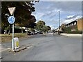
Green Wrythe Lane, The Wrythe
At the junction with Culvers Avenue.
Image: © Nigel Thompson
Taken: 22 Oct 2022
0.07 miles
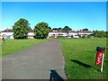
3
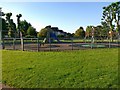
Play area, Dale Park Avenue Recreation Ground
Image: © Alex McGregor
Taken: 28 Jun 2011
0.19 miles
4
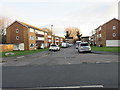
Millside, Hackbridge
Millside is a short residential cul-de-sac in Hackbridge, in the outer suburbs of south London.
Image: © Malc McDonald
Taken: 4 Jan 2020
0.21 miles
5
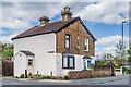
55 & 57 Green Wrythe Lane
Pair of semi-detached cottages in Green Wrythe Lane. The plaque reads "Leicester Cottages 1872".
Image: © Ian Capper
Taken: 25 Apr 2023
0.22 miles
6
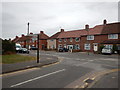
Winchcombe Road
Junction with Welhouse Road.
Image: © James Emmans
Taken: 2 Sep 2016
0.22 miles
7
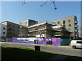
The Lavender being built
It now seems to be known as Lavender Point.
Image: © Robin Webster
Taken: 28 Mar 2012
0.23 miles
8
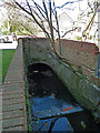
River Wandle backwater
Entering a culvert under Culvers Avenue.
Image: © Robin Webster
Taken: 28 Mar 2012
0.23 miles
9
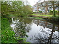
Branch of the River Wandle
Immediately below the Nightingale Road/Hackbridge Road bridge, the Wandle splits into two to form an island which is bisected by Culvers Avenue running east to west. The eastern branch is the main channel. This is the western branch, bordered by the woodland along the edge of Dale Park Recreation Ground. It looks across to flats in Culvers Retreat which are on the island.
Image: © Marathon
Taken: 2 May 2012
0.24 miles