
IMAGES TAKEN NEAR TO
Pipewell Road, CARSHALTON, SM5 1EY
Introduction
This page details the photographs taken nearby to Pipewell Road, SM5 1EY by members of the Geograph project.
The Geograph project started in 2005 with the aim of publishing, organising and preserving representative images for every square kilometre of Great Britain, Ireland and the Isle of Man.

There are currently over 7.5m images from over14,400 individuals and you can help contribute to the project by visiting https://www.geograph.org.uk
Image Map
Images are licensed for reuse under creativecommons.org/licenses/by-sa/2.0
Notes
- Clicking on the map will re-center to the selected point.
- The higher the marker number, the further away the image location is from the centre of the postcode.
Image Listing (24 Images Found)
Images are licensed for reuse under creativecommons.org/licenses/by-sa/2.0
Image
Details
Distance
2
Poulter Park
A housing development near the river Wandle at Morden.
Image: © Stephen Craven
Taken: 29 Aug 2011
0.15 miles
3

Peterborough Road, St Helier
By Poulter Park on the right and the Mitcham pylons crossing as they seem to across most of the area.
Image: © David Howard
Taken: 24 Mar 2014
0.15 miles
4

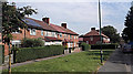
Houses on Peterborough Road, St Helier
Image: © David Howard
Taken: 24 Mar 2014
0.17 miles
5

Shaftesbury Road
Looking south-west down Shaftesbury Road from its junction with Shrewsbury Road
Image: © PhotoMan9000
Taken: 22 Feb 2025
0.18 miles
7
Playing fields by Poulter Park, St Helier
Complete with ubiquitous local pylons, two separate rows.
Image: © David Howard
Taken: 24 Mar 2014
0.19 miles
8
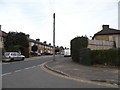
Shaftesbury Road at the junction of Peterborough Road
Image: © David Howard
Taken: 24 Mar 2014
0.20 miles
10
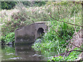
Drainage outfall into the Wandle
There is no side stream marked on the map here so I presume this is either the outfall from land drainage, or (less likely) a storm sewer outfall. It seems to have lost its flap valve.
Image: © Stephen Craven
Taken: 29 Aug 2011
0.23 miles