
IMAGES TAKEN NEAR TO
Garth Road, MORDEN, SM4 4NF
Introduction
This page details the photographs taken nearby to Garth Road, SM4 4NF by members of the Geograph project.
The Geograph project started in 2005 with the aim of publishing, organising and preserving representative images for every square kilometre of Great Britain, Ireland and the Isle of Man.

There are currently over 7.5m images from over14,400 individuals and you can help contribute to the project by visiting https://www.geograph.org.uk
Image Map
Images are licensed for reuse under creativecommons.org/licenses/by-sa/2.0
Notes
- Clicking on the map will re-center to the selected point.
- The higher the marker number, the further away the image location is from the centre of the postcode.
Image Listing (13 Images Found)
Images are licensed for reuse under creativecommons.org/licenses/by-sa/2.0
Image
Details
Distance
1

Merton Council household waste recycling centre
Image: © Bill Boaden
Taken: 13 Sep 2013
0.08 miles

3
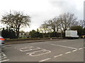
Garth Road, Morden
Overlooking Merton and Sutton cemetery.
Image: © David Howard
Taken: 4 Feb 2013
0.09 miles
4
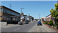
Industrial Estate, Morden Park
A cluster of light-industrial buildings on Garth Road amid suburban housing.
Image: © Stephen Richards
Taken: Unknown
0.12 miles
5
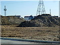
Area for cemetery extension
This appears to have been part of a rubbish site, judging by the state of the heap on the right. It is here in the early stages of being converted into an extension of Merton and Sutton Joint Cemetery.
Image: © Robin Webster
Taken: 1 Apr 2012
0.15 miles
6
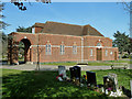
Chapel, Merton and Sutton Joint Cemetery
A simple design compared with the older chapel in the adjacent Morden Cemetery.
Image: © Robin Webster
Taken: 1 Apr 2012
0.16 miles
7
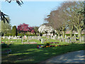
Merton and Sutton Joint Cemetery
The cemetery is next door to Morden Cemetery, which is actually an outpost of Wandsworth Borough.
Image: © Robin Webster
Taken: 1 Apr 2012
0.16 miles
8

Spring blossom, Merton and Sutton Joint Cemetery
The cemetery is next door to Morden Cemetery, which is actually an outpost of Wandsworth Borough.
Image: © Robin Webster
Taken: 1 Apr 2012
0.18 miles
9
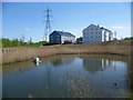
Nature reserve at The Hamptons
In the early 20th century, the Epsom Sewage Farm occupied a small site immediately south of Green Lane. By the 1960s what was now Worcester Park Sewage Works had expanded southwards to cover about half the area now occupied by The Hamptons and after that it further expanded to the east and west. After its closure in the 1990s it was redeveloped to create the Hamptons in a style reminiscent of New England. At the centre of The Hamptons lies a 'town hall', Maple Lodge, which was designed to be the hub for the whole community. Part of the development is a 31 acres new green space called Mayflower Park, which includes a grass amphitheatre for performances and an area of five wetlands forming a nature reserve. This view looks across part of the wetlands to flats in Sherbrooke Way.
Image: © Marathon
Taken: 1 May 2013
0.21 miles
10
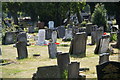
Gravestones in Merton and Sutton Cemetery
As seen from the track which passes between two cemeteries, although for most of its length you don't get a clear view of either.
Image: © Bill Boaden
Taken: 1 Aug 2011
0.21 miles