IMAGES TAKEN NEAR TO
Kew Crescent, SUTTON, SM3 9RU
Introduction
This page details the photographs taken nearby to Kew Crescent, SM3 9RU by members of the Geograph project.
The Geograph project started in 2005 with the aim of publishing, organising and preserving representative images for every square kilometre of Great Britain, Ireland and the Isle of Man.

There are currently over 7.5m images from over14,400 individuals and you can help contribute to the project by visiting https://www.geograph.org.uk
Image Map
Images are licensed for reuse under creativecommons.org/licenses/by-sa/2.0
Notes
- Clicking on the map will re-center to the selected point.
- The higher the marker number, the further away the image location is from the centre of the postcode.
Image Listing (34 Images Found)
Images are licensed for reuse under creativecommons.org/licenses/by-sa/2.0
Image
Details
Distance
1
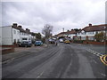
Windsor Avenue, North Cheam
This looks exactly the same as all the roads in Middlesex built around the same time and probably by the same builders,
Image: © David Howard
Taken: 29 Nov 2015
0.14 miles
2
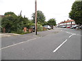
Hamilton Avenue at the junction of Gander Green Lane
Image: © David Howard
Taken: 15 Jun 2014
0.14 miles

4
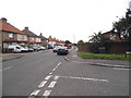
Gander Green Lane at the junction of Hamilton Avenue
Image: © David Howard
Taken: 15 Jun 2014
0.15 miles
5
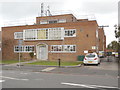
North Cheam Telephone Exchange
Located at 18-20 Abbotts Road SM3 9TB, this redbrick TE dates from the GPO era and serves the North Cheam area. It used to have FAIrlands telephone numbers until the late 1960s, but now has 0208-641 and 644 xxxx numbers plus some other Outer London numbers. A BT vehicle can be seen parked by the gate to the right of the photo, whilst there are mobile phone aerials mounted on the roof of the building.
Image: © David Hillas
Taken: 15 Oct 2016
0.15 miles
6
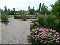
Hamilton Avenue Recreation Ground
Hamilton Avenue Recreation Ground is a relatively new park created as part of Kimpton Open Space. Some 20 years ago there was just a footpath alongside the Pyl Brook and a strip of wildlife habitat between Kimpton Road and the A24 at London Road.
The Pyl Brook is a tributary of the Beverley Brook which in turn feeds into the River Thames up river of Putney. The Pyl Brook runs underground for part of its course upstream before emerging above the ground here. At the time of the 1866 Ordnance Survey Map, this part of the Pyl Brook was surrounded by small fields, bordered by trees and hedges. The rural outlook changed within 30 years as the 1896 Ordnance Survey Map showed a gas holder, a sewage works and a cemetery to the north.
This is the entrance into Hamilton Avenue Recreation Ground from Gander Green Lane.
Image: © Marathon
Taken: 11 Sep 2013
0.16 miles
8
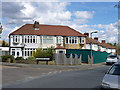
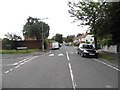
Infilling in North Cheam
A cunning extension of a semi-detached pair into a row of three.
Image: © Robin Webster
Taken: 10 Apr 2012
0.17 miles