
IMAGES TAKEN NEAR TO
Sutton Common Road, SUTTON, SM3 9JA
Introduction
This page details the photographs taken nearby to Sutton Common Road, SM3 9JA by members of the Geograph project.
The Geograph project started in 2005 with the aim of publishing, organising and preserving representative images for every square kilometre of Great Britain, Ireland and the Isle of Man.

There are currently over 7.5m images from over14,400 individuals and you can help contribute to the project by visiting https://www.geograph.org.uk
Image Map
Images are licensed for reuse under creativecommons.org/licenses/by-sa/2.0
Notes
- Clicking on the map will re-center to the selected point.
- The higher the marker number, the further away the image location is from the centre of the postcode.
Image Listing (11 Images Found)
Images are licensed for reuse under creativecommons.org/licenses/by-sa/2.0
Image
Details
Distance

5
South Morden: Forest Road
From its junction with Sutton Common Road
Image: © Dr Neil Clifton
Taken: 26 Jul 2013
0.17 miles
6
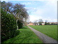
Looking across Sutton Common Park
The area of Sutton Common Park was formerly 'glebe' land administered for the benefit of the people of Sutton. In September 1926, Sutton Urban District Council Finance and Parliamentary Committee recommended a definitive offer of £4,000 for the land now known as Sutton Common Park. This was purchased in 1927. For the history and people's recollections of Sutton Common Park see http://www.foscp.org.uk/new/history.htm
This view looks across the park towards Hartland Way.
Image: © Marathon
Taken: 13 Mar 2013
0.20 miles
7
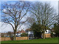
Hartland Way from Sutton Common Park
The area of Sutton Common Park was formerly 'glebe' land administered for the benefit of the people of Sutton. In September 1926, Sutton Urban District Council Finance and Parliamentary Committee recommended a definitive offer of £4,000 for the land now known as Sutton Common Park. This was purchased in 1927. For the history and people's recollections of Sutton Common Park see http://www.foscp.org.uk/new/history.htm
This view looks to the end of Hartland Way where it meets the path between Romany Gardens and Elm Road West.
Image: © Marathon
Taken: 13 Mar 2013
0.20 miles
8
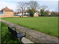
Sutton Common Park
The area of Sutton Common Park was formerly 'glebe' land administered for the benefit of the people of Sutton. In September 1926, Sutton Urban District Council Finance and Parliamentary Committee recommended a definitive offer of £4,000 for the land now known as Sutton Common Park. This was purchased in 1927. For the history and people's recollections of Sutton Common Park see http://www.foscp.org.uk/new/history.htm
This view looks across the park to the end of Hartland Way where it meets the path between Romany Gardens and Elm Road West. The path is on the other side of the wire fence.
Image: © Marathon
Taken: 13 Mar 2013
0.20 miles
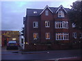
10

Stonecot Service Centre on Sutton Common Road
Image: © David Howard
Taken: 14 Oct 2013
0.23 miles