IMAGES TAKEN NEAR TO
Cookes Lane, SUTTON, SM3 8QG
Introduction
This page details the photographs taken nearby to Cookes Lane, SM3 8QG by members of the Geograph project.
The Geograph project started in 2005 with the aim of publishing, organising and preserving representative images for every square kilometre of Great Britain, Ireland and the Isle of Man.

There are currently over 7.5m images from over14,400 individuals and you can help contribute to the project by visiting https://www.geograph.org.uk
Image Map
Images are licensed for reuse under creativecommons.org/licenses/by-sa/2.0
Notes
- Clicking on the map will re-center to the selected point.
- The higher the marker number, the further away the image location is from the centre of the postcode.
Image Listing (147 Images Found)
Images are licensed for reuse under creativecommons.org/licenses/by-sa/2.0
Image
Details
Distance
9
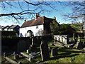
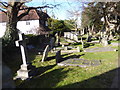
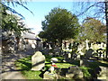
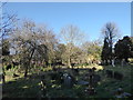
Looking from Cheam Churchyard over to The Old Farmhouse
Image: © Basher Eyre
Taken: 15 Feb 2018
0.03 miles
10
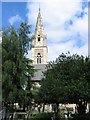
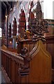
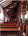
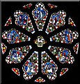
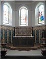
St Dunstans Church, Cheam
A lovely steeple that stands out within these densely populated suburban surroundings. Sits almost opposite Cheam Whitehall.
Image: © Dave Eadie
Taken: 20 Aug 2005
0.03 miles