IMAGES TAKEN NEAR TO
Wickham Avenue, SUTTON, SM3 8EA
Introduction
This page details the photographs taken nearby to Wickham Avenue, SM3 8EA by members of the Geograph project.
The Geograph project started in 2005 with the aim of publishing, organising and preserving representative images for every square kilometre of Great Britain, Ireland and the Isle of Man.

There are currently over 7.5m images from over14,400 individuals and you can help contribute to the project by visiting https://www.geograph.org.uk
Image Map
Images are licensed for reuse under creativecommons.org/licenses/by-sa/2.0
Notes
- Clicking on the map will re-center to the selected point.
- The higher the marker number, the further away the image location is from the centre of the postcode.
Image Listing (18 Images Found)
Images are licensed for reuse under creativecommons.org/licenses/by-sa/2.0
Image
Details
Distance
2
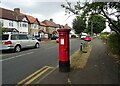
Wickham Avenue, Sutton
Showing position of Postbox No. SM3 163.
See Image] for postbox.
Image: © JThomas
Taken: 25 Jul 2022
0.11 miles

4
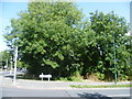
Looking across to woodland alongside London Road, North Cheam
The land along the east side of London Road between Wordsworth Drive and Nonsuch Park was held for possible widening of the A24 but this proposal was dropped. Maps from the second half of the 19th century show London Road as consisting of wide verges with the actual roadway in between. This was a relic of the Enclosues when roads were far wider than they subsequently needed to be before the days of the turnpikes. Roads that carried considerable through traffic like this one had to be wide enough to allow for detours around the boggy morass that usually developed in the winter.
Part of the eastern verge is now this woodland. This is the view across Wickham Avenue with London Road on the left.
Image: © Marathon
Taken: 21 Aug 2013
0.13 miles
5
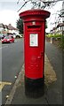
George V postbox on Wickham Avenue, Sutton
Postbox No. SM3 163.
See Image] for context.
Image: © JThomas
Taken: 25 Jul 2022
0.13 miles

7
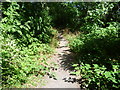
Woodland alongside London Road, North Cheam
The land along the east side of London Road between Wordsworth Drive and Nonsuch Park was held for possible widening of the A24 but this proposal was dropped. Maps from the second half of the 19th century show London Road as consisting of wide verges with the actual roadway in between. This was a relic of the Enclosues when roads were far wider than they subsequently needed to be before the days of the turnpikes. Roads that carried considerable through traffic like this one had to be wide enough to allow for detours around the boggy morass that usually developed in the winter.
Part of the eastern verge is now this woodland. This path leads from Wickham Avenue to Palmer Avenue.
Image: © Marathon
Taken: 21 Aug 2013
0.14 miles
9
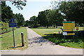
The northern entrance to Nonsuch Park
You don't see this sign until you have already turned off London Road to park.
Image: © Bill Boaden
Taken: 1 Aug 2011
0.14 miles