
IMAGES TAKEN NEAR TO
Holmwood Road, SUTTON, SM2 7JP
Introduction
This page details the photographs taken nearby to Holmwood Road, SM2 7JP by members of the Geograph project.
The Geograph project started in 2005 with the aim of publishing, organising and preserving representative images for every square kilometre of Great Britain, Ireland and the Isle of Man.

There are currently over 7.5m images from over14,400 individuals and you can help contribute to the project by visiting https://www.geograph.org.uk
Image Map
Images are licensed for reuse under creativecommons.org/licenses/by-sa/2.0
Notes
- Clicking on the map will re-center to the selected point.
- The higher the marker number, the further away the image location is from the centre of the postcode.
Image Listing (23 Images Found)
Images are licensed for reuse under creativecommons.org/licenses/by-sa/2.0
Image
Details
Distance
1
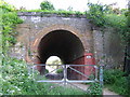
Railway bridge, East Ewell
This railway bridge provides access to the open parkland.
Image: © Brian Green
Taken: 14 May 2008
0.07 miles
2
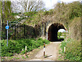
Railway bridge BTH2/282
This takes the Sutton to Epsom line over what is now only a public footpath, with cycling concession.
Image: © Robin Webster
Taken: 10 Apr 2012
0.10 miles
3
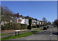
Bramley Road, Cheam
Heading south, The London Loop long distance path has just left the grassy expanse of Nonsuch Park and now has about 2 km of roadside walking along streets all very similar to Bramley Road here before getting to the next green stretch at Banstead Downs.
Image: © Des Blenkinsopp
Taken: 26 Mar 2012
0.10 miles
4
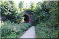
Footpath to Bramley Road, Cheam
The land on this side of the railway bridge is access land next to Nonsuch Park though not part of it.
Image: © Bill Boaden
Taken: 1 Aug 2011
0.11 miles
5
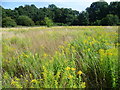
Warren Farm
The London LOOP passes across the field of Warren Farm on its way from Ewell to Nonsuch Park. Here it passes through the grassland ahead and under the railway between Cheam and Ewell East, which is on an embankment covered by the trees beyond.
Warren Farm was given to the Woodland Trust Reserve in 1994. In August it is colourful with the bright yellow of goldenrod as can be seen here.
Image: © Marathon
Taken: 21 Aug 2013
0.12 miles
6
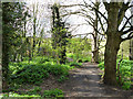
A way out of Nonsuch Park
A way to a bridge under the railway on the left emerging on Holmwood Road.
Image: © Robin Webster
Taken: 10 Apr 2012
0.13 miles
7
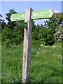
Milepost for London Loop, the Warren
To the right:
Banstead Downs 2 1/4 miles ; Coulsdon 4 miles ; Petts Wood 31 Miles
To the left:
Bourne Hall 1 1/4 mile ; Kingston Bridge 8 1/4 miles ; Uxbridge Lock 28 miles
and, coming out from the front: Ewell East Station
Image: © Brian Green
Taken: 14 May 2008
0.13 miles
8
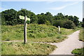
Footpath junction near Cheam
The footpaths are on an area of open land adjoining Nonsuch Park.
Image: © Bill Boaden
Taken: 1 Aug 2011
0.15 miles
9
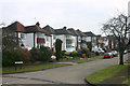
Bramley Road, Cheam
Taken from beneath the railway bridge shown on one of the Geographs for this square.
Image: © David Kemp
Taken: 14 Feb 2009
0.15 miles
10
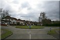
Roundabout, Buckland Road and Abinger Avenue
Image: © Hugh Craddock
Taken: 22 Feb 2009
0.16 miles