IMAGES TAKEN NEAR TO
Cuddington Way, SUTTON, SM2 7JA
Introduction
This page details the photographs taken nearby to Cuddington Way, SM2 7JA by members of the Geograph project.
The Geograph project started in 2005 with the aim of publishing, organising and preserving representative images for every square kilometre of Great Britain, Ireland and the Isle of Man.

There are currently over 7.5m images from over14,400 individuals and you can help contribute to the project by visiting https://www.geograph.org.uk
Image Map
Images are licensed for reuse under creativecommons.org/licenses/by-sa/2.0
Notes
- Clicking on the map will re-center to the selected point.
- The higher the marker number, the further away the image location is from the centre of the postcode.
Image Listing (11 Images Found)
Images are licensed for reuse under creativecommons.org/licenses/by-sa/2.0
Image
Details
Distance
1
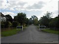
Golf Side private road, Cheam
This secluded street is a privately owned road which skirts Cuddington Golf Course, hence its name.
Image: © Hywel Williams
Taken: 19 Sep 2005
0.10 miles
2
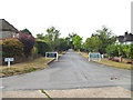
Belmont: Golf Side
From Cuddington Way
Image: © Dr Neil Clifton
Taken: 27 Jul 2013
0.13 miles
4
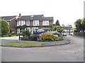
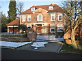
Houses on Cheyham Way, Belmont
1970s style neo-Georgian
Image: © David Howard
Taken: 1 Jun 2014
0.15 miles
5
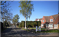
Cheyham Way
Another of the suburban roads on the London Loop path making up the roadside section between Nonsuch Park and Banstead Downs.
Image: © Des Blenkinsopp
Taken: 26 Mar 2012
0.16 miles
6
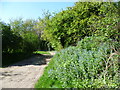
Cuddington Golf Course
Cuddington Golf Course is an 18 hole course, designed in 1929. Deriving its name from Cuddington, a village which disappeared during the reign of Henry VIII, this golf course lies in a shallow dry valley on the chalk. It has an irregular shape due to enclaves of housing and is in a very exclusive area. Much the larger part is to the south of Cuddington Way but this is the small part to the north of Cuddington Way.
Image: © Marathon
Taken: 16 Apr 2014
0.21 miles
8
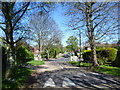
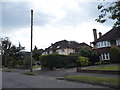
Cuddington Way and the London LOOP
The London LOOP here follows Cuddington Way on its way from Nonsuch Park to Banstead Downs. Just ahead beyond the white gates it turns right up Sandy Lane. This is a very exclusive area. The other end with its white markers as well can be seen at http://www.geograph.org.uk/photo/3934995
Image: © Marathon
Taken: 16 Apr 2014
0.23 miles
9
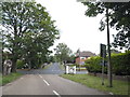
Cuddington Way at the junction of Sandy Lane
Image: © David Howard
Taken: 1 Jun 2014
0.23 miles