
IMAGES TAKEN NEAR TO
Rookley Close, SUTTON, SM2 6TT
Introduction
This page details the photographs taken nearby to Rookley Close, SM2 6TT by members of the Geograph project.
The Geograph project started in 2005 with the aim of publishing, organising and preserving representative images for every square kilometre of Great Britain, Ireland and the Isle of Man.

There are currently over 7.5m images from over14,400 individuals and you can help contribute to the project by visiting https://www.geograph.org.uk
Image Map
Images are licensed for reuse under creativecommons.org/licenses/by-sa/2.0
Notes
- Clicking on the map will re-center to the selected point.
- The higher the marker number, the further away the image location is from the centre of the postcode.
Image Listing (18 Images Found)
Images are licensed for reuse under creativecommons.org/licenses/by-sa/2.0
Image
Details
Distance
1

Epsom Downs branch
The single track persists all the way to and including the terminus now. The days of packed race day specials are over.
Image: © Robin Webster
Taken: 11 Apr 2012
0.08 miles
2
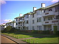
The Chilterns, Brighton Road, Belmont
Art Deco apartment blocks off B2230
Image: © Noel Foster
Taken: 13 Sep 2005
0.08 miles
3

Plate on railway bridge NFE 1242, Epsom Downs branch
The name is from when the road was a drive to Belmont hospital, now gone. Other plates are a bit further along - see Image
Image: © Robin Webster
Taken: 11 Apr 2012
0.15 miles
4

Plates on Homeland Drive railway bridge - railway and road
There is also another plate, giving a 1984 reconstruction date, when the London Borough of Sutton called it Belmont Hospital Bridge. Apt, as it carried the drive to the hospital. See Image This is a 2012 view. Since then, the green plate has gone and a big railway plastic plate has appeared which calls the bridge a mysterious 'Hospital/School'.
Image: © Robin Webster
Taken: 11 Apr 2012
0.15 miles
5
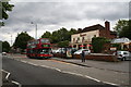
'The Belmont', Brighton Road, Belmont, Surrey
This large and busy public house stands on the main road southwards out of Sutton, (here the B2230). The bus in front on Route 280 is nearly at its terminus. It is a Plaxton-bodied Volvo (PVL 110) and has come from Tooting via Sutton, but one more stop and it will reach its Belmont terminus. A frequent service is provided, which is just as well, as the train only runs once an hour.
Image: © Dr Neil Clifton
Taken: 26 Jun 2007
0.19 miles

7
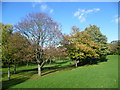
Belmont Park
Belmont Park is a small narrow park between Brighton Road (B2230) and the Sutton to Belmont railway line. Belmont station lies at its southern end. When this photograph was taken the autumn colours were just starting to come out.
Image: © Marathon
Taken: 4 Nov 2013
0.20 miles
8
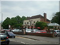
The Belmont public house, Belmont, Surrey
Image: © Stacey Harris
Taken: 3 Jun 2009
0.20 miles
10
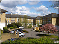
Housing on Kingswood Drive
Built in the grounds of the former Belmont Hospital.
Image: © Robin Webster
Taken: 11 Apr 2012
0.20 miles