
IMAGES TAKEN NEAR TO
Mulgrave Road, SUTTON, SM2 6LF
Introduction
This page details the photographs taken nearby to Mulgrave Road, SM2 6LF by members of the Geograph project.
The Geograph project started in 2005 with the aim of publishing, organising and preserving representative images for every square kilometre of Great Britain, Ireland and the Isle of Man.

There are currently over 7.5m images from over14,400 individuals and you can help contribute to the project by visiting https://www.geograph.org.uk
Image Map
Images are licensed for reuse under creativecommons.org/licenses/by-sa/2.0
Notes
- Clicking on the map will re-center to the selected point.
- The higher the marker number, the further away the image location is from the centre of the postcode.
Image Listing (103 Images Found)
Images are licensed for reuse under creativecommons.org/licenses/by-sa/2.0
Image
Details
Distance
1
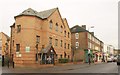
Mulgrave Road, Sutton
My best friend at school lived in a flat over the shops at Mulgrave Court, on the right. Mulgrave Chambers, the offices in the foreground, certainly weren't there then.
Image: © Derek Harper
Taken: 3 Feb 2011
0.02 miles
2
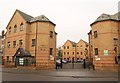
Mulgrave Chambers, Sutton
The block on the right of this three-block courtyard office development appears on the left of Image
Image: © Derek Harper
Taken: 3 Feb 2011
0.03 miles
3
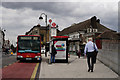
Sutton Railway Station
Seen from Brighton Road.
Image: © Peter Trimming
Taken: 9 Jun 2015
0.03 miles
5
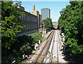
Sutton-Cheam railway (1)
Looking north-east with Sutton station just ahead. The building on the left is Royal Mail offices. The tower ahead is Vigilant House (1961-66, by Robert J. Wood and Partners).
Taken from the aptly-named Bridge Road.
Image: © Stephen Richards
Taken: Unknown
0.03 miles
8
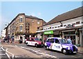
Outside Sutton Station
Sutton Station was opened on 10th May 1847 by the London Brighton and South Coast Railway.....back in the days when taxis were black....
Image: © Des Blenkinsopp
Taken: 23 May 2012
0.04 miles
9
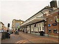
Sutton Station
The entrance on the Brighton Road, with some patterns in the pavers. Could that be some problem with the ticket machine? Plans are afoot to redevelop the station as a public transport interchange involving a tram terminus.
Image: © Derek Harper
Taken: 3 Feb 2011
0.04 miles
10
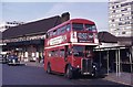
London RT bus on route 164A at Sutton Station
Many of London's bus routes penetrated into the surrounding countryside and the 164A ran from Morden Underground Station via Sutton and Banstead to Tattenham Corner, terminating close to the famous race course. There have been many changes over the past 33 years since this photo was taken. The bus is RT 3986.
Image: © JOHN PARKIN
Taken: 7 Sep 1976
0.04 miles