
IMAGES TAKEN NEAR TO
The Crescent, SUTTON, SM2 6BJ
Introduction
This page details the photographs taken nearby to The Crescent, SM2 6BJ by members of the Geograph project.
The Geograph project started in 2005 with the aim of publishing, organising and preserving representative images for every square kilometre of Great Britain, Ireland and the Isle of Man.

There are currently over 7.5m images from over14,400 individuals and you can help contribute to the project by visiting https://www.geograph.org.uk
Image Map
Images are licensed for reuse under creativecommons.org/licenses/by-sa/2.0
Notes
- Clicking on the map will re-center to the selected point.
- The higher the marker number, the further away the image location is from the centre of the postcode.
Image Listing (34 Images Found)
Images are licensed for reuse under creativecommons.org/licenses/by-sa/2.0
Image
Details
Distance
1
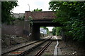
Bridges at Belmont, Surrey
Taken looking southwards from the Up side of the single line, the nearer bridge is that carrying Station Road, while in the distance, Brighton Road also crosses the line, this time by an oblique bridge.
Image: © Dr Neil Clifton
Taken: 26 Jun 2007
0.07 miles
2
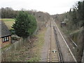
Railway line south of Belmont, towards Banstead
Image: © Nigel Thompson
Taken: 2 Apr 2015
0.08 miles
3
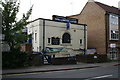
Belmont British Legion
On the south side of Station Road just west of the bridge. A banner outside was appealing for new members.
Image: © Dr Neil Clifton
Taken: 26 Jun 2007
0.09 miles
4
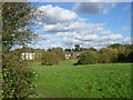
Banstead Downs
The total area of Banstead Downs which remains is only a tiny fragment of an enormous tract of mostly unenclosed downland and woodland which formerly stretched from Carshalton in the north to the scarp slope of the North Downs near Reigate in the south. This was one of the last large remaining areas of the ancient Royal Forest which covered the entire county of Surrey in medieval times. Banstead Downs once boasted several racecourses, but these were gradually superseded by Epsom Downs.
Enclosure of the downs started in the 18th century and accelerated during the next hundred years but there was still much open country in the mid-19th century. After a long legal battle what remained of Banstead Downs was granted to the Corporation of London by an Act of Parliament of 1893.
Since the Second World War much of the downs has been invaded by scrub and woodland and little open grass land now remains. This area near Belmont station is one such area. The houses and flats in the distance are on Downs Road.
Image: © Marathon
Taken: 4 Nov 2013
0.10 miles
5
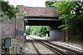
Station Road bridge, Belmont, Surrey
This substantial bridge, situated at the Down end of Belmont station, carries Station Road, which links the shops at Belmont village to the main Brighton road.
Image: © Dr Neil Clifton
Taken: 26 Jun 2007
0.11 miles
6
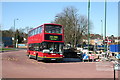
Belmont bus terminus, Surrey
This point is within walking distance of Belmont station, and also (a little further away) the Marsden Hospital. Route 280, operated by London General, runs here from St. George's Hospital, Tooting. The vehicle shown is PVL 107, a low floor Plaxton-bodied Volvo double decker.
Image: © Dr Neil Clifton
Taken: 15 Mar 2007
0.12 miles
8
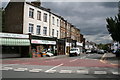
Station Road, Belmont, looking east
From the western end where Station Road joins Queens Road
Image: © Dr Neil Clifton
Taken: 26 Jun 2007
0.12 miles
9
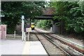
Leaving Belmont Station, Surrey
A Down train is just disappearing from view as it heads along the single track to Epsom Downs with the once-hourly service that is provided here.
Image: © Dr Neil Clifton
Taken: 26 Jun 2007
0.13 miles
10
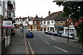
Station Road, Belmont, Surrey
Looking west. The junction with Belmont Road is on the right just before the teak-fronted shop
Image: © Dr Neil Clifton
Taken: 26 Jun 2007
0.13 miles