IMAGES TAKEN NEAR TO
Cheviot Close, SUTTON, SM2 5SB
Introduction
This page details the photographs taken nearby to Cheviot Close, SM2 5SB by members of the Geograph project.
The Geograph project started in 2005 with the aim of publishing, organising and preserving representative images for every square kilometre of Great Britain, Ireland and the Isle of Man.

There are currently over 7.5m images from over14,400 individuals and you can help contribute to the project by visiting https://www.geograph.org.uk
Image Map
Images are licensed for reuse under creativecommons.org/licenses/by-sa/2.0
Notes
- Clicking on the map will re-center to the selected point.
- The higher the marker number, the further away the image location is from the centre of the postcode.
Image Listing (13 Images Found)
Images are licensed for reuse under creativecommons.org/licenses/by-sa/2.0
Image
Details
Distance
1
The Warren
Road of large detached houses with large gardens first marked on the 1935 25 inch map. The 1913 edition showed the area as woodland, also named The Warren, while the 1895 edition showed it as Carshalton Downs.
Image: © Ian Capper
Taken: 26 Apr 2023
0.13 miles
2
Beeches Walk, Carshalton Beeches
Looking towards the junction with Banstead Road South.
Image: © Robin Webster
Taken: 18 Jan 2020
0.13 miles
3
Beeches Walk, Carshalton Beeches
A view of Beeches Walk, a residential road in Carshalton Beeches in the outer suburbs of south London.
Image: © Malc McDonald
Taken: 11 Jan 2020
0.16 miles
4
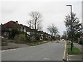
Banstead Road South, Carshalton Beeches
Banstead Road South is a residential road in Carshalton Beeches, in the outer suburbs of south London.
Image: © Malc McDonald
Taken: 11 Jan 2020
0.17 miles
6
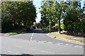
Carshalton Beeches: Chiltern Road
Looking west, from its junction with Banstead Road South. Chiltern Road runs through from here to join Brighton Road B2230.
Image: © Dr Neil Clifton
Taken: 5 Sep 2012
0.18 miles
7
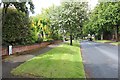
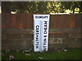
Boundary marker, Chiltern Road, Sutton
The boundary is between Carshalton and Sutton & Cheam.
Image]
Image: © Bob Embleton
Taken: 24 May 2014
0.19 miles
8
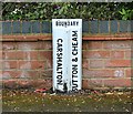
Boundary marker (detail), Chiltern Road, Sutton
Between Carshalton and Sutton & Cheam.
Image]
Image: © Bob Embleton
Taken: 24 May 2014
0.19 miles
9
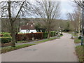
Beeches Walk, Carshalton
Beeches Walk is a residential road in Carshalton Beeches, in the outer suburbs of south London.
This image was taken in winter, while trees were bare.
Image: © Malc McDonald
Taken: 11 Jan 2020
0.19 miles