
IMAGES TAKEN NEAR TO
Oxford Road, GERRARDS CROSS, SL9 8TB
Introduction
This page details the photographs taken nearby to Oxford Road, SL9 8TB by members of the Geograph project.
The Geograph project started in 2005 with the aim of publishing, organising and preserving representative images for every square kilometre of Great Britain, Ireland and the Isle of Man.

There are currently over 7.5m images from over14,400 individuals and you can help contribute to the project by visiting https://www.geograph.org.uk
Image Map
Images are licensed for reuse under creativecommons.org/licenses/by-sa/2.0
Notes
- Clicking on the map will re-center to the selected point.
- The higher the marker number, the further away the image location is from the centre of the postcode.
Image Listing (14 Images Found)
Images are licensed for reuse under creativecommons.org/licenses/by-sa/2.0
Image
Details
Distance
1
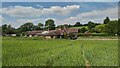
Public Footpath passes the Pig and Whistle Lodge
Small hamlet on the Oxford Road surrounded by farmland.
Image: © James Emmans
Taken: 23 Jun 2021
0.02 miles
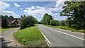
3
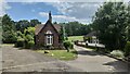
Lodge house to Bulstrode Park and Mansion
One of the two lodges on the Oxford Road. The mansion has a long and interesting history and was even owned by the Bruderhof in the 1950's before they settled in Kent.
http://bulstrodecamp.co.uk/about-items/local-history/bulstrode-park/
Image: © James Emmans
Taken: 23 Jun 2021
0.02 miles
4
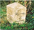
Old Milestone by the A40, west of Chalfont St Peter
Carved stone post by the A40, in parish of Chalfont St Peter (Chiltern District), Oxford Road; Mumfords Farm, opposite Pig & Whistle Lodge, on wide grass verge in front of ditch, on North side of road. Beaconsfield diamond pillar, erected by the Red Hill & Beaconsfield turnpike trust in the 18th century.
Inscription reads:-
: London / 21 / - / Oxford / 33 / - : : Uxbridge / 6 : : Wycombe / 8 (painted on) :
Carved benchmark on top.
Buckinghamshire HER.
HER Number: 1361800000 https://www.heritagegateway.org.uk/Gateway/Results_Single.aspx?uid=MBC25811&resourceID=1024
Milestone Society National ID: BU_LW21
Image: © A Rosevear & J Higgins
Taken: 25 Oct 2001
0.03 miles
10
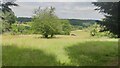
Farmland near Jerretts Hill
This land was sold off to the local farmers when Bulstrode was sold in the 1950's.
Image: © James Emmans
Taken: 23 Jun 2021
0.15 miles