IMAGES TAKEN NEAR TO
Windsor Road, GERRARDS CROSS, SL9 8ST
Introduction
This page details the photographs taken nearby to Windsor Road, SL9 8ST by members of the Geograph project.
The Geograph project started in 2005 with the aim of publishing, organising and preserving representative images for every square kilometre of Great Britain, Ireland and the Isle of Man.

There are currently over 7.5m images from over14,400 individuals and you can help contribute to the project by visiting https://www.geograph.org.uk
Image Map
Images are licensed for reuse under creativecommons.org/licenses/by-sa/2.0
Notes
- Clicking on the map will re-center to the selected point.
- The higher the marker number, the further away the image location is from the centre of the postcode.
Image Listing (17 Images Found)
Images are licensed for reuse under creativecommons.org/licenses/by-sa/2.0
Image
Details
Distance
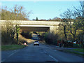
1
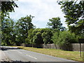
Windsor Road, Gerrards Cross
This is at the southern fringe of the town, looking south with the road about to go down into the Alderbourne valley and under the M40 motorway. There are houses set back among the trees.
Image: © David Hawgood
Taken: 22 Jun 2005
0.12 miles
2
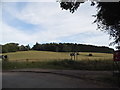
View by Hedgerley Lane, Gerrards Cross
Looking towards High Meadows
Image: © David Howard
Taken: 15 Jun 2017
0.16 miles
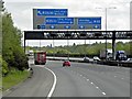
4
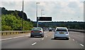
M40 at Gerrards Cross (1)
Southbound between junctions 2 and 1A
Image: © MrC
Taken: 4 Aug 2012
0.18 miles
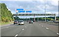
6
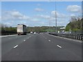
M40 Motorway southwest of Gerrards Cross
Image: © Peter Whatley
Taken: 12 Apr 2011
0.19 miles
7
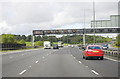
M40 near Gerrards Cross (2)
Northbound between junctions 1A and 2
Image: © MrC
Taken: 13 Oct 2012
0.19 miles
8
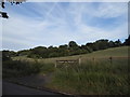
Field by Hedgerley Lane, Gerrards Cross
Image: © David Howard
Taken: 15 Jun 2017
0.19 miles
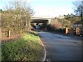
9
B416 under M40
Windsor Road has 'Flood' signs in place after much recent rain, but the dip here has dried out now.
Image: © Robin Webster
Taken: 19 Jan 2014
0.20 miles
10
Fulmer: B416 Windsor Road and the M40 Motorway
The M40 Motorway crosses over the B416 Windsor Road here, this section of which once formed part of the A332 road. The Civil Parish boundary, between Fulmer to the right and Hedgerley to the left, passes down the centre of the road, although the motorway bridge is entirely within Fulmer. At the time the photograph was taken the road drainage gullies opposite one another before the bridge had become blocked, causing flooding on both sides of the road. This in turn resulted in some entertaining driving behaviour...
Image: © Nigel Cox
Taken: 22 Dec 2013
0.21 miles