IMAGES TAKEN NEAR TO
Old Amersham Road, GERRARDS CROSS, SL9 7BE
Introduction
This page details the photographs taken nearby to Old Amersham Road, SL9 7BE by members of the Geograph project.
The Geograph project started in 2005 with the aim of publishing, organising and preserving representative images for every square kilometre of Great Britain, Ireland and the Isle of Man.

There are currently over 7.5m images from over14,400 individuals and you can help contribute to the project by visiting https://www.geograph.org.uk
Image Map
Images are licensed for reuse under creativecommons.org/licenses/by-sa/2.0
Notes
- Clicking on the map will re-center to the selected point.
- The higher the marker number, the further away the image location is from the centre of the postcode.
Image Listing (35 Images Found)
Images are licensed for reuse under creativecommons.org/licenses/by-sa/2.0
Image
Details
Distance
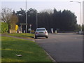
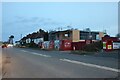
3
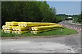
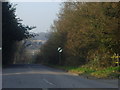
Tatling End: A413 Amersham Road
Racks of new gas pipes awaiting installation are stored at the junction of the Old Amersham Road with the current one.
Image: © Nigel Cox
Taken: 11 May 2008
0.05 miles
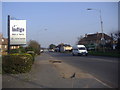
4
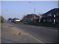
Junction of Old Amersham Road and A40, Tatling End
Image: © David Howard
Taken: 8 Mar 2011
0.06 miles
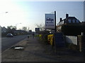
9
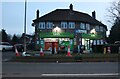
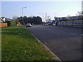
Londis on Oxford Road, Denham
Londis is short for London Independent Supermarkets
Image: © David Howard
Taken: 17 Feb 2022
0.09 miles