
IMAGES TAKEN NEAR TO
Copthall Lane, GERRARDS CROSS, SL9 0BX
Introduction
This page details the photographs taken nearby to Copthall Lane, SL9 0BX by members of the Geograph project.
The Geograph project started in 2005 with the aim of publishing, organising and preserving representative images for every square kilometre of Great Britain, Ireland and the Isle of Man.

There are currently over 7.5m images from over14,400 individuals and you can help contribute to the project by visiting https://www.geograph.org.uk
Image Map
Images are licensed for reuse under creativecommons.org/licenses/by-sa/2.0
Notes
- Clicking on the map will re-center to the selected point.
- The higher the marker number, the further away the image location is from the centre of the postcode.
Image Listing (13 Images Found)
Images are licensed for reuse under creativecommons.org/licenses/by-sa/2.0
Image
Details
Distance
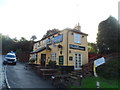
2

Rickmansworth Lane Plaque (2)
This plaque is located on a lamp post in Rickmansworth Lane near Copthall Lane. It is one of several plaques on the Celfunde Inheritance Walk in the Chalfont St Peter area and has the following wording:
Rickmansworth Lane looking south west.
Looking towards Gravel Hill with Copthall Lane
to the left, The Waggon & Horses and Peewit
Castle beyond and Hill House to the right.
Image: © David Hillas
Taken: 3 Aug 2025
0.05 miles
3

Rickmansworth Road, Chalfont St Peter
At the junction of Gravel Hill.
Image: © David Howard
Taken: 31 Dec 2024
0.05 miles
4
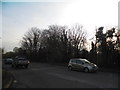
Gravel Hill at the junction of Copthall Lane
Image: © David Howard
Taken: 28 Feb 2013
0.07 miles
5
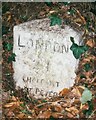
Old Milestone by the A413 in Chalfont St Peter
Carved stone post by the A413, in parish of Chalfont St Peter (Chiltern District), Gravel Hill; 50m South of junction with Copthall Lane, beside drive to Azania, within an ivy covered bank under ragged hedge, behind footpath, on East side of road. Amersham limestone square, erected by the Wendover & Oak Lane turnpike trust in the 18th century.
Inscription reads:-
LONDON
21
CHALFONT
ST PETER
Buckinghamshire HER.
HER Number: 1420300000 https://www.heritagegateway.org.uk/Gateway/Results_Single.aspx?uid=MBC32751&resourceID=1024
Milestone Society National ID: BU_LC21
Image: © A Rosevear & J Higgins
Taken: 21 Aug 2003
0.08 miles
6
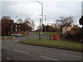
Gravel Hill Junction
Two roads leave the A413 at this point climbing up the valley side to the north and east respectively.
Image: © David Squire
Taken: 5 Dec 2005
0.08 miles
7
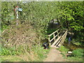
Chalfont St Peter: Footbridge over the River Misbourne
Curiously the current Ordnance Survey 1:50,000 scale mapping has the footpath approaching the footbridge from the west then terminating at it. In practice it continues eastwards up to Gravel Hill, as shown by the sign.
Image: © Nigel Cox
Taken: 25 Apr 2010
0.17 miles
8

Chalfont St. Peter & Chalfont St. Giles Parish Councils
Image: © Bryn Holmes
Taken: 27 Jan 2023
0.19 miles
9

Gravel Hill Plaque by ambulance station
This metal plaque is located on a wooden fence by the local ambulance station in Gravel Hill. It is one of several Celfunde Inheritance Heritage Walk plaques around Chalfont St Peter and has the following wording:
Gravel Hill. Looking east up Gravel Hill towards
Amersham. All the buildings here were
demolished to make way for the bypass.
Image: © David Hillas
Taken: 7 Aug 2025
0.19 miles
10
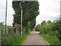
Chalfont St Peter: Mystery road sign
According to the Highway Code the road sign on the left warns of a "Level crossing with barrier or gate ahead", and given its juxtaposition on the page with the sign with a steam engine on it warning of a "Level crossing without barrier or gate ahead" the implication is that we are coming up to a railway here. You would have to walk an awful long distance along the South Bucks Way from here to find the next railway level crossing! Anyway the sign is on the minor road between the River Misbourne on the right and Chalfont St Peter Football Club's ground on the left.
Image: © Nigel Cox
Taken: 24 May 2015
0.19 miles