IMAGES TAKEN NEAR TO
Riversdale, BOURNE END, SL8 5XP
Introduction
This page details the photographs taken nearby to Riversdale, SL8 5XP by members of the Geograph project.
The Geograph project started in 2005 with the aim of publishing, organising and preserving representative images for every square kilometre of Great Britain, Ireland and the Isle of Man.

There are currently over 7.5m images from over14,400 individuals and you can help contribute to the project by visiting https://www.geograph.org.uk
Image Map
Images are licensed for reuse under creativecommons.org/licenses/by-sa/2.0
Notes
- Clicking on the map will re-center to the selected point.
- The higher the marker number, the further away the image location is from the centre of the postcode.
Image Listing (34 Images Found)
Images are licensed for reuse under creativecommons.org/licenses/by-sa/2.0
Image
Details
Distance
1
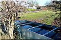
Pasture at Hollands Farm
What snow there was has gone, but it is still well below freezing and the water in this drinking trough is still well frozen. Can it be well frozen? Does the ice get harder the colder it gets or is there a maximum hardness? The animals in the pasture had been taken elsewhere as well.
Image: © Graham Horn
Taken: 5 Dec 2010
0.06 miles
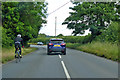
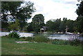
3
Orange Way after Wiltshire (419)
This view is across the river to a boathouse next to a large dwelling.
Image: © Shazz
Taken: 31 Aug 2013
0.11 miles
5
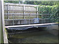
River Wye at Bourne End
Viewed at about 300 metres upstream of its confluence with the River Thames, the clear water of the River Wye flows here under the Wessex Road bridge and over a weir where the disturbed water can be seen on the downstream side. The blue and white "Private Property Keep Off" sign belongs to another era when the National Rivers Authority was responsible for the management of rivers, rather than the Environment Agency.
Image: © Nigel Cox
Taken: 8 Jul 2007
0.12 miles
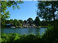
6
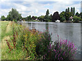
The River Thames, Cookham
Viewed from the meadows on the Berkshire bank. Properties in Bourne End occupy the Buckinghamshire side.
Image: © Andrew Smith
Taken: 8 Aug 2009
0.12 miles
8
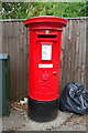
Elizabeth II postbox on Wessex Road, Bourne End
Postbox No. SL8 218.
Image: © JThomas
Taken: 26 May 2022
0.14 miles
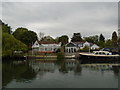
9
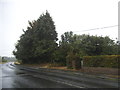
Bend on Ferry Lane, Bourne End
This is also next to the first house entering the town on the right
Image: © David Howard
Taken: 12 Jul 2015
0.14 miles