IMAGES TAKEN NEAR TO
Hawks Hill, BOURNE END, SL8 5JH

Introduction

This page details the photographs taken nearby to Hawks Hill, SL8 5JH by members of the Geograph project.

The Geograph project started in 2005 with the aim of publishing, organising and preserving representative images for every square kilometre of Great Britain, Ireland and the Isle of Man.

There are currently over 7.5m images from over14,400 individuals and you can help contribute to the project by visiting https://www.geograph.org.uk

Image Map


Images are licensed for reuse under creativecommons.org/licenses/by-sa/2.0
Notes
  • Clicking on the map will re-center to the selected point.
  • The higher the marker number, the further away the image location is from the centre of the postcode.

Image Listing (19 Images Found)

Images are licensed for reuse under creativecommons.org/licenses/by-sa/2.0
Image
Details
Distance
1
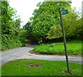
Bridleway junction with Hawk's Hill
Image: © Shazz Taken: 13 May 2013
0.02 miles
2
NEW Navigating northwards up the Bashire (52)
Approaching the junction of Harvest Hill and Heavens Lea
Image: © Basher Eyre Taken: 29 Oct 2024
0.13 miles
3
Modern house on Kiln Lane, Wooburn
You can just see the house next door which was built at the same time, probably after the late 60s, but this has had a refit and new windows and cladding put on.
Image: © David Howard Taken: 8 Mar 2015
0.14 miles
4
Looking west along Kiln Lane to the roundabout at Cores End
Image: © Shazz Taken: 13 May 2013
0.19 miles
5
Kiln Lane
A steep part of the rural road towards Cores End.
Image: © James Emmans Taken: 4 May 2021
0.20 miles
6
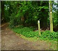
Bridleway from Harvest Hill to Hawks Hill
Image: © James Emmans Taken: 4 May 2021
0.20 miles
7
Cores End Road, Wooburn Town
Image: © David Howard Taken: 10 Jul 2022
0.20 miles
8
Bridleway junction north of Harvest Hill
Image: © Shazz Taken: 13 May 2013
0.20 miles
9
Cores End Road at the junction of Kiln Lane
Image: © David Howard Taken: 10 Jul 2022
0.20 miles
10
Church on Brookbank, Wooburn
Image: © David Howard Taken: 8 Mar 2015
0.21 miles