1
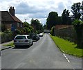
A late summer game
A late summer game on the Little Marlow cricket ground
Image: © Shaun Ferguson
Taken: 13 Sep 2008
0.04 miles
2
The Old Red Telephone Box at Little Marlow
This is at the junction of Church Road and School Lane. It is on the route of the London Green Belt Way.
Image: © Sean Davis
Taken: 28 Jul 2007
0.06 miles
3
Church Road, Little Marlow
The white house in the distance is Manor Farm and behind the wall on the right is the Manor House.
Image: © Sean Davis
Taken: 28 Jul 2007
0.08 miles
4
Pound Lane, Little Marlow
The building in the distance is The Queen's Head. Just past the pub the lane narrows to footpath and leads to Marlow.
Image: © Sean Davis
Taken: 28 Jul 2007
0.09 miles
5
The northern end of Little Marlow
Image: © Andrew Smith
Taken: 24 Dec 2005
0.09 miles
6
Queen's Head, Little Marlow
The 16th century Queen's Head in Pound Lane, Little Marlow. It was one of Morse's favourite watering holes the TV series Inspector Morse, and often appeared in Midsomer Murders. A public footpath from here leads all the way to Marlow.
Image: © Sean Davis
Taken: 28 Jul 2007
0.10 miles
7
Phone box in Little Marlow
Image: © Chad Nyhus
Taken: 22 Mar 2009
0.11 miles
8
Church Road, Little Marlow
At the southern end of the village by the church and manor house.
Image: © Des Blenkinsopp
Taken: 20 Feb 2017
0.11 miles
9
The Small Green on Church Road, Little Marlow
This is where the road widens, next to the lychgate, war memorial and Manor Farm. It is on the route of the London Green Belt Way.
Image: © Sean Davis
Taken: 28 Jul 2007
0.11 miles
10
Old Vicarage, Little Marlow
View from public footpath.
Image: © David Hawgood
Taken: 14 Jul 2021
0.11 miles


