IMAGES TAKEN NEAR TO
Monkton Lane, MARLOW, SL7 3FG
Introduction
This page details the photographs taken nearby to Monkton Lane, SL7 3FG by members of the Geograph project.
The Geograph project started in 2005 with the aim of publishing, organising and preserving representative images for every square kilometre of Great Britain, Ireland and the Isle of Man.

There are currently over 7.5m images from over14,400 individuals and you can help contribute to the project by visiting https://www.geograph.org.uk
Image Map
Images are licensed for reuse under creativecommons.org/licenses/by-sa/2.0
Notes
- Clicking on the map will re-center to the selected point.
- The higher the marker number, the further away the image location is from the centre of the postcode.
Image Listing (14 Images Found)
Images are licensed for reuse under creativecommons.org/licenses/by-sa/2.0
Image
Details
Distance
1
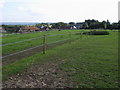
Wood Barn Farm
From the Chiltern Way looking to Wood Barn Farm
Image: © Shaun Ferguson
Taken: 13 Sep 2008
0.03 miles
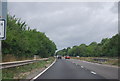
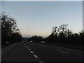
7
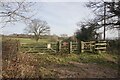
Chiltern Way leaving Burroughs Grove
Part of a 125 mile circular route, here heading east from Pump Lane North.
Image: © Bill Boaden
Taken: 27 Jan 2024
0.16 miles
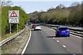
10
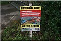
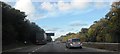
A local campaign
There is popular opposition to a planning application for a film studio which will occupy a large area on the other side of the A404.
Image: © Bill Boaden
Taken: 27 Jan 2024
0.19 miles