IMAGES TAKEN NEAR TO
Marlow Common, MARLOW, SL7 2QP
Introduction
This page details the photographs taken nearby to Marlow Common, SL7 2QP by members of the Geograph project.
The Geograph project started in 2005 with the aim of publishing, organising and preserving representative images for every square kilometre of Great Britain, Ireland and the Isle of Man.

There are currently over 7.5m images from over14,400 individuals and you can help contribute to the project by visiting https://www.geograph.org.uk
Image Map
Images are licensed for reuse under creativecommons.org/licenses/by-sa/2.0
Notes
- Clicking on the map will re-center to the selected point.
- The higher the marker number, the further away the image location is from the centre of the postcode.
Image Listing (4 Images Found)
Images are licensed for reuse under creativecommons.org/licenses/by-sa/2.0
Image
Details
Distance
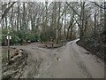
2
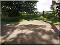
Dappled light and gate off near to Marlow Common
Image: © Bikeboy
Taken: 23 Jun 2012
0.22 miles
3
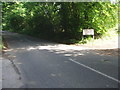
Entrance to Valley View Stables off Frieth Road
Image: © Bikeboy
Taken: 23 Jun 2012
0.24 miles
4
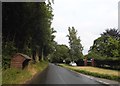
Marlow Common
Rural road passing Marlow Common on the left.
Image: © James Emmans
Taken: 25 Feb 2021
0.24 miles